
National Capital Plan Amendment (No.100 – Knowles Place Alignment) Amending Instrument 2024
I, Kristy McBain, Minister for Regional Development, Territories and Local Government, make the following instrument.
Dated 4 February 2025
Kristy McBain
Minister for Regional Development, Territories and Local Government
1 Name
This instrument is the National Capital Plan Amendment (No.100 – Knowles Place Alignment) Amending Instrument.
2 Commencement
(1) Each provision of this instrument specified in column 1 of the table commences, or is taken to have commenced, in accordance with column 2 of the table. Any other statement in column 2 has effect according to its terms.
Commencement information |
Column 1 | Column 2 | Column 3 |
Provisions | Commencement | Date/Details |
1. The whole of this instrument | The day after this instrument is registered. | |
Note: This table relates only to the provisions of this instrument as originally made. It will not be amended to deal with any later amendments of this instrument.
(2) Any information in column 3 of the table is not part of this instrument. Information may be inserted in this column, or information in it may be edited, in any published version of this instrument.
3 Authority
This instrument is made under paragraph 19(1)(a) of the Australian Capital Territory (Planning and Land Management) Act 1988.
4 Schedules
Each instrument that is specified in a Schedule to this instrument is amended or repealed as set out in the applicable items in the Schedule concerned, and any other item in a Schedule to this instrument has effect according to its terms.
Schedule 1—Amendments
National Capital Plan
1. Part Four – Designated Areas and Special Requirements
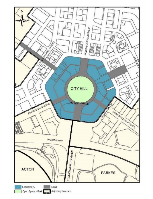
Section 4.6.4 – Land Use for City Hill Precinct
Repeal Figure 39: Land use for the City Hill Precinct and substitute with the following:
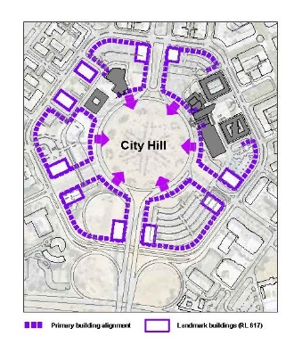
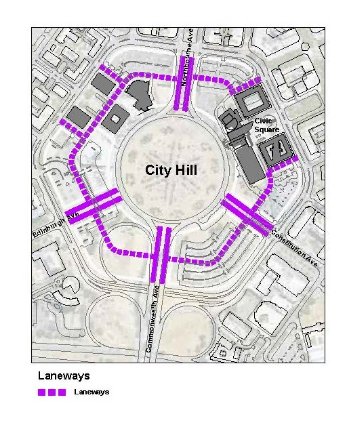
2. Section 4.6.5 Detailed conditions of planning, design and development
Repeal Figure 40: City Hill – Indicative Development and substitute with the following:

Repeal Figure 42: City Hill – Indicative building form, height and landmark buildings and substitute with the following:
Repeal Figure 46: City Hill – Indicative laneways and substitute with the following:
Consequential changes
The Draft Amendment will recognise consequential changes to page numbers, figure numbers and text references, and contents page.