Summary
1. Introduction
The Solitary Islands Marine Reserve (Commonwealth waters) (the ‘Reserve’) is located in the Coffs Harbour region of the New South Wales (NSW) mid-north coast. The Reserve adjoins the seaward boundary of the NSW Solitary Islands Marine Park (the ‘Park’) and extends to the 50 metre depth contour. The Park is 710 square kilometres in area with the Reserve covering a further 160 square kilometres.
The Reserve is of great conservation significance as it contains a relatively undisturbed, distinct and species-rich ecosystem associated with open ocean, subtidal reef, and soft substrate habitats.
This is the first Management Plan for the Reserve (the ‘Plan’).
2. Management Framework
The Solitary Islands Marine Reserve was proclaimed in 1993 under the National Parks and Wildlife Conservation Act 1975 (NPWC Act). On 16 July 2000 the Environment Protection and Biodiversity Conservation Act 1999 (EPBC Act) replaced the NPWC Act. The provisions of the EPBC Act and EPBC Regulations apply to the planning and management of the Reserve.
The Reserve is managed under a cooperative management agreement between the Director of National Parks and the NSW Marine Parks Authority (NSW MPA). The terms of the agreement are established in a Schedule to the Memorandum of Understanding. The NSW MPA generally undertakes the day-to-day management of the Reserve on behalf of the Director.
The Reserve is included on the Register of the National Estate.
It is part of the National Representative System of Marine Protected Areas (NRSMPA), which aims to establish and manage a comprehensive, adequate and representative system of marine protected areas.
3. Strategic Objectives
The strategic objectives of the Reserve are as follows:
– Protect the conservation values of the Reserve from human induced damages.
– Protect the benthic communities of pinnacle reef habitat and associated sensitive marine species and established ecological processes at Pimpernel Rock.
– Protect a representative sample of whole reef complex, including soft substrate sediments and subtidal reef habitats, deep water biotic communities and predator–prey assemblages, mammals and seabirds.
– Protect key habitat for listed threatened species such as grey nurse sharks Carcharius taurus and cetaceans, and implement management arrangements that are consistent with the species recovery plans under the EPBC Act.
– Effectively manage activities that can impact upon marine wildlife especially cetaceans and other listed threatened species and on sensitive marine habitats.
– Allow for a range of recreational and commercial activities in the Reserve to the extent they do not conflict with the above objectives and are consistent with the principles of ecologically sustainable development.
– Develop management arrangements for the Reserve that are consistent with and complementary to the management regime of the Park to the extent possible.
– Manage the Reserve as part of a comprehensive, adequate and representative system of marine protected areas to contribute to the long-term ecological viability of marine and estuarine systems.
4. Description of the Solitary Islands Marine Reserve
The Solitary Islands’ marine environment supports a high biodiversity of tropical, subtropical and temperate species and has great scientific, social, cultural and economic significance. The region supports high diversity and abundance of species of algae (over 150 species), corals (over 90 species), fish (over 280 species), marine reptiles and mammals, and seabirds. Of significance is the diversity and abundance of the hard reef-building corals at this southerly latitude.
The Reserve comprises three relatively undisturbed and species rich ecosystems: subtidal reefs, soft substrate sediments and open ocean habitats. Water quality is generally good given the northern section of the Reserve is adjacent to the terrestrial Yuraygir National Park.
A significant feature is Pimpernel Rock, a submerged pinnacle in the north of the Reserve, with steep slopes dominated by algae, corals, sponges and ascidians, which provides habitat for benthic communities, pelagic fish, grey nurse sharks and marine turtles. Dolphins are always present, seals and dugong occur rarely and the Reserve is on the migratory path of the humpback and southern right whales.
Due to the diversity and beauty of the corals, marine life and seascape of the Reserve, the area is important to scientists, scuba divers and underwater photographers. Other significant activities in the Reserve include commercial and recreational fishing, whale and dolphin watching, yacht racing and general boating activities.
5. Pressures on the Solitary Islands Marine Reserve
The Reserve attracts a high number of users from all sectors and the pressures placed upon it are varied. General pressures on the marine environment arise from coastal and marine development in the vicinity of the Reserve. Urban and rural development contribute to land based sources of marine pollution that include sediments, nutrients, chemicals, and sewage. Vessels passing through the region may also contribute to marine pollution through potential oil spills. Discarded waste from fishing boats and other vessels has significant impacts on wildlife.
The main pressures on the biodiversity values of the Reserve are fishing activities, as the Reserve is located in waters important to commercial fishing, recreational fishing, charter fishing, and collecting activities. Benthic communities and habitats are highly vulnerable to trawling. The main pressure affecting the open ocean habitat is potential over-harvesting of pelagic species. However, the Reserve is a small proportion of the area of waters in the region for these fisheries and the direct impact on the Reserve needs further assessment.
Some scuba diving activities, particularly those involving inexperienced divers, may impact on reef ecosystems by abrading corals and disturbing sensitive marine species such as the grey nurse shark. Boating can lead to anchor damage on subtidal reefs and be a striking hazard to cetaceans in the Reserve. Inappropriate whale and dolphin viewing behaviour is a pressure that is increasingly affecting cetacean behaviour and movement patterns in the Reserve. Poorly controlled research may have impacts on biodiversity values in the Reserve.
6. Management of the Solitary Islands Marine Reserve
The primary objective of the Reserve is to maintain ecological processes and systems and to protect the habitats and biodiversity in the Commonwealth waters of the Solitary Islands region. A secondary objective is to apply management practices for the sustainable use of the Reserve. The Reserve also provides enhanced protection to the estuarine habitats, sandy beaches, coastal rocky shores, and island fringing reefs of the adjacent NSW Marine Park.
To meet these objectives the Reserve is assigned by the Plan to IUCN (World Conservation Union) category VI — a managed resource protected area. Two special management zones are established by the Plan in the northern section of the Reserve, namely a Sanctuary Zone (IUCN category Ia — strict nature reserve) and a Habitat Protection Zone (IUCN category IV — habitat/species management area). These zones have similar provisions to the zones used in the adjoining State marine park. The provisions for the management plan are consistent with the Australian IUCN Reserve Management Principles for each IUCN category to which the Reserve and zone of the Reserve is assigned by the Plan.
A summary of key management goals for the Reserve
– Protect the benthic ecosystems, established ecological processes, and the environmentally sensitive structure of Pimpernel Rock and surrounding subtidal reef habitats from human impacts.
– Facilitate the recovery of grey nurse sharks in a way that is consistent with the recovery plan actions that apply to key aggregation sites in marine protected areas.
– Protect a representative sample of whole reef complex, including soft substrate sediments and subtidal reef habitats, deep water biotic communities and predator-prey assemblages, mammals and seabirds.
– Protect the Reserve from marine pollution, including debris and oil spills, associated with shipping activities in the area.
– Ensure that commercial operators conduct their activities in a manner that is safe and ecologically sustainable, and that is consistent with the strategic objectives of the Reserve.
– Provide for activities that contribute to regional and national development to the extent that this is consistent with the strategic objectives of the Reserve.
– Ensure there is no damage to biodiversity values and other natural values of the Reserve from petroleum and mineral exploration and development activities.
– Develop research and monitoring programs that will provide information for management, including gaining a better understanding of natural environments of the Reserve and impact of human activities.
A summary of main management strategies for the Reserve
– Work closely with all relevant Commonwealth and State government agencies and users of the Reserve to raise awareness of the location of the zones within the Reserve, management prescriptions and the significance of its primary conservation values.
– Develop permit conditions for activities allowed by the Plan in consultation with the NSW MPA, industry groups, NSW Fisheries, the Australian Fisheries Management Authority (AFMA), and other stakeholders.
– Work closely with the NSW MPA, NSW Fisheries, AFMA, the Australian Maritime Safety Authority (AMSA), Coastwatch and other stakeholders regarding surveillance, enforcement and compliance activities and to monitor the level of fishing and vessel activity in the Reserve.
– Liaise with the NSW MPA, research organisations, and other stakeholders to develop and implement a performance assessment system and a scientific research and monitoring strategy that will include:
– monitoring of activities, impacts and compliance in the Reserve, such as community satisfaction with Reserve management, protection of threatened species, effects of trawling and other fishing methods, and land-based sources of marine pollution;
– monitoring the status of the ecosystems of the Reserve with non-intrusive techniques; and
– further survey work to build on existing knowledge of conservation values.
7. Reviewing This Plan
This Plan includes the general foundation of a performance assessment system that includes strategic objectives, management goals and management strategies. The detailed performance measures, monitoring programs and targets will be developed during the implementation of the Plan. Some of these performance measures and monitoring programs will relate to the impacts of activities in the Reserve, status of benthic communities including subtidal reefs, and investigating the effectiveness of zoning and other management measures.
The Plan will operate for seven years unless revoked or amended sooner, and it will be reviewed approximately two years before its expiry. Results from the performance assessment program will be used to undertake this review. The results of the review will be used in the development of the next Management Plan for the Solitary Islands Marine Reserve (Commonwealth waters).
1. Introduction
The Solitary Islands region is an area of great conservation significance. It covers a large section of the waters off the north coast of New South Wales, the adjacent littoral/intertidal ecosystems, coral-fringed islands and rocky outcrops, soft substrate sediments, subtidal reefs, pinnacles, and open ocean ecosystems. The biological diversity and other values of the region are protected under adjoining State and Commonwealth marine protected areas: the Commonwealth Solitary Islands Marine Reserve (the ‘Reserve’) and the NSW Solitary Islands Marine Park (the ‘Park’). Due to their outstanding diversity and beauty, both the Reserve and the Park were included on the Register of the National Estate in 1995 (Australian Heritage Commission 2000).
The Park extends from the mean high water mark out to the three nautical mile limit of the coastal waters of the State of New South Wales from Coffs Harbour north to Sandon River on the mid-north coast of NSW. The Reserve adjoins the seaward boundary of the Park and extends to the 50 metre depth contour (Figure 1). The Park is 710 square kilometres in area with the Reserve covering a further 160 square kilometres.
The Reserve was proclaimed on 17 February 1993 under the National Parks and Wildlife Conservation Act 1975 (NPWC Act) (Attachment 1). It encompasses the waters, seabed and subsoil beneath the seabed to a depth of 1000 metres, within the area described in the proclamation. The Park was declared in 1998 under the Marine Parks Act 1997 (NSW). Previous to this it was a marine reserve, declared in May 1991 under the Fisheries and Oyster Farms Act 1935.
The Commonwealth Reserve protects and conserves a relatively undisturbed, distinct and species-rich ecosystem associated with its open ocean, subtidal reef, and soft substrate habitats. Pimpernel Rock is the most significant feature in the Reserve. It is a submerged pinnacle that rises from the seabed to within a few metres of the surface, providing habitat for benthic communities, pelagic fish, grey nurse sharks Carcharias taurus, black cod Epinephilus damelii, and marine turtles.
The primary objective of the Reserve is to maintain ecological processes and systems and to protect the habitats and biodiversity in the Commonwealth waters of the Solitaries region. A secondary objective is to apply management practices for the sustainable use of the Reserve. The Reserve also provides enhanced protection to the estuarine habitats, sandy beaches, coastal rocky shores and island fringing reefs of the adjacent NSW Marine Park.
To meet these objectives, the Management Plan for the Reserve (the ‘Plan’) provides for most of the Reserve to be managed as a General Use Zone to allow for continuation of all ecologically sustainable activities currently undertaken within the Reserve, in conjunction with measures to maintain its biological diversity and other natural values. Two special management zones are established by the Plan in the northern section of the Reserve. A Sanctuary Zone, which is an area within a 500 metre radius around the centre of Pimpernel Rock, is to be managed as a ‘no take’ area to protect the pinnacle benthic communities, established ecological processes, and associated sensitive marine species. A Habitat Protection Zone protects a representative sample of whole reef complex, including soft substrate sediments and subtidal reef habitats, deep water biotic communities and predator-prey assemblages, mammals and seabirds.
This is the first management plan for the Commonwealth Solitary Islands Marine Reserve. It has been prepared in consultation with the New South Wales Marine Parks Authority (NSW MPA). As separate management plans are required for each jurisdiction, the management goals and strategies described herein apply to the Commonwealth Reserve only. However, to ensure consistent and complementary management arrangements across the Park and the Reserve, the zones applied to the Commonwealth Reserve have similar provisions to the zones used in the adjoining State Marine Park.


2. Management Framework
2.1 National and International Context
The Reserve and the Park are part of the National Representative System of Marine Protected Areas (NRSMPA). The NRSMPA aims to establish and manage a comprehensive, adequate and representative system of marine protected areas and to contribute to the long-term ecological viability of marine systems, to maintain ecological processes, and to protect Australia’s biological diversity at all levels (ANZECC 1999). One of the secondary goals of the NRSMPA is to provide for the special needs of threatened species, migratory species, and species vulnerable to disturbance. Marine protected areas within the NRSMPA have been established especially for the conservation of biological diversity and have a secure status.
The Commonwealth Government’s commitment to the NRSMPA was reaffirmed through Australia’s Oceans Policy (Environment Australia 1998), which identifies the need to protect marine biodiversity through Marine Protected Areas. The NRSMPA is being implemented cooperatively by Commonwealth, State and Northern Territory Governments, through the Australian and New Zealand Environment and Conservation Council, under the Intergovernmental Agreement on the Environment.
Establishment of the Reserve assists Australia in meeting its obligations under the Convention on Biological Diversity 1992. This Convention requires parties to pursue the conservation of biological diversity and the sustainable use of its components. A key feature of the Convention is the establishment of a system of protected areas where special measures need to be taken to conserve biological diversity.
Management of the Reserve will also be consistent with obligations for migratory species listed under the Convention on Migratory Species of Wild Animals (Bonn Convention), the International Convention on the Regulation of Whaling, the Japan–Australia Migratory Birds Agreement (JAMBA) and the China–Australia Migratory Birds Agreement (CAMBA).
2.2 Legislative Context
The Solitary Islands Marine Reserve is a Commonwealth reserve under the Environment Protection and Biodiversity Conservation Act 1999 (EPBC Act). Administration, management and control of Commonwealth reserves are the function of the Director of National Parks. The Director’s functions and powers in relation to the Solitary Islands Marine Reserve and other Commonwealth marine reserves have been delegated to the head of the Marine and Water Division of Environment Australia.
The EPBC Act requires the Director to prepare management plans for Commonwealth reserves. When prepared, the plans are given to the Minister for the Environment and Heritage for approval. A management plan is a “disallowable instrument”, and when approved must be tabled in each House of the Commonwealth Parliament. Either House of the Parliament may disallow a plan. A management plan for a Commonwealth reserve has effect for seven years, subject to being revoked or amended earlier by another management plan for the reserve.
Under the EPBC Act (s. 367) a management plan for a Commonwealth reserve must provide for the protection and conservation of the reserve and must assign the reserve to one of the following IUCN (World Conservation Union) protected area categories:
– Ia strict nature reserve;
– Ib wilderness area;
– II national park;
– III natural monument;
– IV habitat/species management area;
– V protected landscape/seascape; or
– VI managed resource protected area.
In preparing a plan the EPBC Act (s.368) also requires account to be taken of various matters. In respect to the Solitary Islands Marine Reserve these matters include:
– regulation of the use of the reserve for the purpose for which it was declared; and
– the interests of any Indigenous persons interested in the reserve; and
– the interests of any person who has a usage right relating to land, sea or seabed in the reserve that existed (or is derived from a usage right that existed) immediately before the reserve was declared; and
– the protection of the special features of the reserve, including objects and sites of biological, historical, palaeontological, archaeological, geological and geographical interest; and
– the protection, conservation and management of biodiversity and heritage within the reserve; and
– the protection of the reserve against damage; and
– Australia’s obligations under agreements between Australia and one or more other countries relevant to the protection and conservation of biodiversity and heritage.
The EPBC Act (s. 354) imposes a range of controls and restrictions on activities in Commonwealth reserves. Certain acts are prohibited except in accordance with a management plan. These acts are:
– kill, injure, take, trade, keep or move a member of a native species; or
– damage heritage; or
– carry on an excavation; or
– erect a building or other structure; or
– carry out works; or
– take an action for commercial purposes.
These controls and restrictions do not affect certain traditional activities by Indigenous people. In addition, special provisions apply if prior usage rights exist over seabed in a marine reserve. Mining operations are also prohibited unless the Governor-General has approved them and they are carried out in accordance with a management plan.
As noted earlier, the Reserve was declared under the NPWC Act, which was replaced by the EPBC Act on 16 July 2000. The EPBC Act has also replaced four other Commonwealth Acts. They were the Environment Protection (Impact of Proposals) Act 1974, Endangered Species Protection Act 1992, Whale Protection Act 1980 and World Heritage Properties Conservation Act 1983. These other parts of the EPBC Act will also be relevant to the management of the Reserve and the taking of actions in and in relation to the Reserve.
In particular, actions that would or are likely to have a significant impact on a specified matter of “national environmental significance” will be subject to the assessment and approval provisions of the EPBC Act. The matters of national environmental significance identified in the Act as triggers for the Commonwealth assessment and approval regime are:
– World Heritage properties;
– wetlands of international importance (Ramsar wetlands);
– listed threatened species and communities;
– listed migratory species;
– nuclear actions;
– the marine environment; and
– such further actions as are prescribed by the EPBC Regulations under the Act.
The Solitary Islands Marine Reserve is a “Commonwealth marine area” for the purposes of the Act. The taking of an action in a Commonwealth marine area (including the airspace above it) that will or is likely to have a significant impact on the environment, or the taking of an action outside a Commonwealth marine area that will or is likely to have a significant impact on the environment in a Commonwealth marine area, will be subject to the assessment and approvals provisions of the EPBC Act. The person proposing to take the action must refer proposed actions that may require approval from the Commonwealth Environment Minister.
The EPBC Act also contains provisions that prohibit and regulate actions in relation to threatened species, migratory species, cetaceans (whales and dolphins), and ‘listed’ marine species. Civil and criminal penalties may be imposed for breaches of the Act.
2.3 Management of the Solitary Islands Marine Reserve
The Reserve is managed for the Director under a cooperative management agreement with the NSW MPA. The terms of the agreement are established in a Schedule to the Memorandum of Understanding that details the management, operational and resourcing arrangements pertaining to the cooperative management of the Park and the Reserve. The NSW MPA generally undertakes the day-to-day management of the Reserve on behalf of Environment Australia.
The strategic objectives, management goals and management strategies for the Reserve will, to the maximum extent possible, be consistent with the management regime to be developed by the NSW MPA for the Park. Accordingly, the zones applied to the Commonwealth Reserve have similar provisions to the zones used in the adjoining State marine park.
The Reserve overall is assigned by the Plan as an IUCN protected area management category VI (managed resource protected area). The Plan then divides the Reserve into three zones and assigns them to IUCN categories (see Figure 2).
1 General Use Zone (IUCN category VI) applies to most of the Reserve, allowing for all ecologically sustainable activities currently undertaken within the Reserve to continue, in conjunction with measures to maintain its biological diversity and other natural values;
2 Sanctuary Zone (IUCN category Ia — strict nature reserve) encompasses the area within a 500 metre radius around the centre of Pimpernel Rock and provides a ‘no-take’ area, primarily to protect the pinnacle benthic communities, established ecological processes, and associated sensitive marine species such as grey nurse sharks;
3 Habitat Protection Zone (IUCN category IV — habitat/species management area ) encompasses the Sanctuary Zone and protects a representative sample of whole reef complex, including soft substrate sediments and subtidal reef habitats, deep water biotic communities and predator-prey assemblages, mammals and seabirds.
The provisions of a management plan for a Commonwealth reserve must be consistent with the Australian IUCN Reserve Management Principles for the IUCN category to which the reserve or zone of a reserve is assigned by the plan. The principles, prescribed by the Environment Protection and Biodiversity Conservation Regulations 2000 (EPBC Regulations), identify the purpose or purposes for which a Commonwealth reserve, or zone of a reserve, assigned to the category is primarily to be managed. Principles relevant to the Solitary Islands Marine Reserve are described in Attachment 2.
Commercial fishing in the Reserve is mainly managed by NSW Fisheries under the Fisheries Management Act 1994 (NSW). This is done pursuant to arrangements made under the Fisheries Management Act 1991 (Commonwealth) whereby a State is given jurisdiction for a particular fishery that occurs in both the coastal waters of the State and in Commonwealth waters. There are also a number of Commonwealth fisheries active in the Reserve that are managed by the Australian Fisheries Management Authority (AFMA) under the Fisheries Management Act 1991 (Commonwealth).
Commercial fishing is an action for commercial purposes that must not be carried on except in accordance with a management plan. Under regulation 12.34 commercial fishing can be carried on in a Commonwealth reserve if authorised by a relevant Commonwealth, State or Territory law (for example, the Fisheries Management Act 1991 (Commonwealth)) or a permit issued under the EPBC Regulations. It also provides for the Director to make determinations affecting the conduct of commercial fishing. A determination may provide that: specified kinds of

fishing gear cannot be carried or used; specified kinds of fishing gear are required to be carried or used by a person who is fishing or intending to fish; specified practices in commercial fishing are prohibited; and specified practices in commercial fishing are to be followed.
In those areas of the Reserve where this Plan allows for commercial fishing a permit issued by the Director will not generally be required. Permits may be required, or determinations may be made, by the Director where the Director considers that conditions over and above those applying to Commonwealth or New South Wales fishing concessions are required to ensure the activity is compatible with the strategic objectives of the Reserve or zones within the Reserve. Such conditions may include prohibitions on fishing gear and practices.
3. Strategic Objectives
The strategic objectives for the Reserve are designed to comply with the EPBC Act, the Strategic Plan of Action for the National Representative System of Marine Protected Areas; A Guide for Action by Australian Governments (ANZECC 1999), the Guidelines for Protected Area Management (IUCN 1994) and the Australian IUCN Reserve Management Principles (regulation 10.04 of the EPBC Regulations). They form the basis of this Plan and are presented below:
– Protect the conservation values of the Reserve from human induced damages.
– Protect the benthic communities of pinnacle reef habitat, established ecological processes, and associated sensitive marine species at Pimpernel Rock.
– Protect a representative sample of whole reef complex, including soft substrate sediments and subtidal reef habitats, deep water biotic communities and predator-prey assemblages, mammals and seabirds.
– Protect key habitat for listed threatened species such as grey nurse sharks Carcharius taurus and cetaceans, and implement management arrangements consistent with the species recovery plans under the EPBC Act.
– Effectively manage activities that can impact on marine wildlife, especially cetaceans and other listed threatened species, and on sensitive marine habitats.
– Allow for a range of recreational and commercial activities in the Reserve to the extent they do not conflict with above objectives and are consistent with the principles of ecologically sustainable development (Attachment 3).
– Develop management arrangements for the Reserve that are consistent with and complementary to the management regime for the Park to the extent possible.
– Manage the Reserve as part of a comprehensive, adequate and representative system of marine protected areas to contribute to the long-term ecological viability of marine and estuarine systems.
4. Description of the Solitary Islands
Marine Reserve
4.1 Summary
The following description of the Reserve is largely drawn from the report on the State of the Environment of the Solitary Islands Marine Park (Zann 2000), the Solitary Islands Marine Park and the Solitary Islands Marine Reserve Planning Issues and Options Paper (NSW MPA 2000) and the Coffs Harbour City Council Draft State of the Environment Report 2000 (CHCC 2000).
4.2 Conservation Values — Abiotic
4.2.1 Climate
The north coast of New South Wales experiences a subtropical climate with a mean air temperature ranging from 13.7°C to 23.2°C. This is characterised by warm humid conditions in summer when the easterly trade winds dominate from January to March, and dry cool conditions in winter. Average annual precipitation for the area is 1,700mm, with the majority of rainfall occurring between December and May.
4.2.2 Geomorphology
The geological structure of the coastline adjacent to the Reserve consists of the Clarence Morton Basin, which is a sedimentary structure formed during the Triassic to early Cretaceous period. It comprises a sequence of Mesozoic sediments and volcanics resting on a basement of folded Palaeozoic rocks. Quaternary fluvial sediments are extensive around major rivers. The New England fold belt is the most eastern geological province of mainland Australia and it is composed of late Paleozoic complexes intruded by Permian and Triassic granites.
CONTINENTAL SHELF
The physical environment of the Australian continental shelf is almost entirely soft sediments with offshore rocky reefs comprising a very small proportion of the shelf.
The continental shelf near the Reserve is around 12–20 nautical miles wide. Beyond the shelf break, the continental slope falls steeply into deep abyssal waters. The shelf sediments consist mainly of terrigenous material from rivers and streams, and relic quartzose and carbonate rich sands.
Subtidal reefs in the Reserve are mostly derived from marine sediments of the Coffs Harbour sequence. These rocks have been folded and metamorphosed into a sequence of sandstones and cherts. Erosion has selectively removed the softer strata leaving the more resistant rocky outcrops as a north-south line of islands and submerged reefs.
4.2.3 Oceanography
temperature and salinity
Water temperatures monitored by automatic data-loggers in the Reserve and the Park from 1992 to 1994 ranged from 16.5°C to 26.6°C. Daily variations are small during the cooler months of April to November, but much greater during summer months, with variations of 4°C in a single day, and 7.4°C within a two-day period. Temperatures dropped below 18°C (considered the minimum for coral reef formation) for more than 20 days per year.
Although salinities in the Reserve region have not been monitored, they are expected to consistently be at oceanic levels because of the strong influence of the East Australian Current. The high wave energy of the area would also tend to break down stratified, low-density freshwater lenses.
waves and tides
Wave energy is dominated by the predominant wind-driven southeast swells. Cyclonic swells occasionally occur during summer and approach from the east. Wind-driven continental shelf waves are a primary source of current variability in the area. Tides are semi-diurnal in nature with a maximum tidal range of two metres.
light and nutrients
Light and nutrients have not been systematically monitored in the Reserve. The East Australian Current is a tropical watermass that is characteristically low in nutrients and sediments (Burrage 1993). The high transparency of the offshore shelf waters enables sufficient light to reach the sea floor for macro-algae and coral growth.
currents: the prevailing east australian current
The East Australian Current is a moderately strong western (Pacific) boundary current and acts as a major influence in the area. It carries a mixture of tropical and subtropical waters from the Coral Sea, Great Barrier Reef region, and southern Queensland into the more temperate area of the NSW continental shelf before separating from the coast between the Solitary Islands and Smokey Cape (Zann 2000). This current overlaps with the colder northward-flowing inshore current resulting in a complex mixture of communities in which marine species normally associated with the Great Barrier Reef can be found along with species from Tasmania.
The influence of the East Australian Current often extends onto the coast, creating a southward flowing current in the nearshore region. The velocity of the East Australian Current is variable, depending on prevailing winds, but rates of three to four knots (five to six kilometres per hour) are reported.
In some areas, strong coastal flows of the East Australian Current may force deeper, cold and nutrient-rich waters to the surface (upwellings) to produce a nearshore, northwards flowing counter current. On occasions, the direction of current flow may be reversed due to northward flowing coastally trapped waves that originate in Bass Strait and southern NSW.
water quality
The Park abuts 14 estuaries and approximately 500 hectares of estuarine waterways. The six main estuaries from north to south are the Sandon, Wooli Wooli and Corindi Rivers, and Arrawarra, Moonee and Coffs Creeks. In general, once offshore, coastal sediments migrate in a northerly direction because of the predominant southeasterly winds and swell.
Water quality in the northern section of the Reserve is generally good as estuaries in the area are largely protected by the terrestrial Yuraygir National Park. Estuaries draining into the southern section of the Reserve flow through catchments that are highly urbanised or intensively cultivated (Coffs Harbour City Council 2000). Water quality of receiving southern Reserve waters is unlikely to be affected as the fast flowing East Australian Current would rapidly flush most contaminants from the area.
4.3 Conservation Values — Species
The Solitary Islands region supports many species of algae (over 150 species), corals (over 90 species), fish (over 280 species), marine reptiles and mammals, and sea and shore birds. The total diversity of species within the Reserve is not known. The marine invertebrates in this area occupy an important transitional region between tropical and subtropical areas, so for many species the region may represent either its southern or northern limit (pers. comm. Australian Coral Reef Society). Of particular interest in the Reserve are those species listed as threatened or subject to international and national conservation agreements. These include:
– humpback whale;
– southern right whale;
– marine turtles;
– grey nurse shark;
– great white shark;
– little tern; and
– wandering albatross.
All cetaceans (whales, dolphins and porpoises), dugong, listed marine species and listed migratory species are protected in Commonwealth waters under the EPBC Act.
4.3.1 Fish
sharks
The Reserve contains some significant areas of habitat for the grey nurse shark Carcharias taurus. A recovery plan for this listed threatened species is currently being prepared under s.178 of the EPBC Act. The species may be found in the Reserve throughout the year, but is generally most abundant when water temperatures are around 18–19°C, from April to November.
Grey nurse sharks display a habitat preference for gutters in reefs and submarine caves. They are long-lived (30–35 years), slow breeding animals that usually only produce two young per litter every two years. Historical accounts (Otway and Parker 1999a, 2000), NSW Fisheries records and recent surveys indicate that Pimpernel Rock provides significant habitat for grey nurse sharks and is the only known habitat for this species within a Commonwealth marine protected area.
Recent surveys conducted along the NSW coast by Otway and Parker (2000) have observed aggregations of up to 15 grey nurse shark at Pimpernel Rock. Of the 21 locations surveyed, Pimpernel Rock was one of 13 to record aggregations of five or more grey nurse sharks. Research by Parker (1998) and Otway and Parker (2000) found a high proportion of grey nurse shark sightings within the Reserve at Pimpernel Rock. Grey nurse shark are generally seen inside the cavern and in the gutters fringing the cavern (see Figure 3). The species is mainly encountered there during autumn, winter and spring with occasional sightings in summer (Otway and Parker 2000). Further, Otway and Parker (2000) suggest that it is likely that these sites may play an important role in pupping and/or mating activities. Many sharks have been observed in the Brooms Head area (that includes Pimpernel Rock) during the months of March and April with mating scars, bite marks around the pectoral fins and head area (D. White cited in Otway and Parker 2000).
The white pointer or great white shark Carcharodon carcharias, is occasionally seen in the Reserve around dropoffs and at Pimpernel Rock (NSW MPA 2000). A recovery plan is currently being prepared for this listed threatened species under the EPBC Act.
other fish
The pelagic fish in open ocean habitats include baitfish such as yellowtail, slimy mackerel, and predatory fish such as kingfish, Spanish mackerel and tunas. Nearer the seafloor common species include the blue spot flathead and red spot whiting (NSW MPA 2000).
A project currently being undertaken by NSW Fisheries and the Australian Museum has identified a number of potentially threatened fish species within the Park and the Reserve (Pogonoski et al., in press). Those potentially threatened species that live in the Reserve (Pimpernel Rock) include the giant Queensland groper Epinephilus lanceolatus, and the Bleekers devil fish (or blue devil fish) Paraplesiops bleekeri, and the black cod Epinephilus damelii.
Waters in the region have amongst the highest densities of anemone fish recorded in the world (Richardson 1996). Species include widespread black anemone fish Amphiprion melanopus, Barrier Reef anemone fish Amphiprion akindynos, and the subtropical anemone fish Amphiprion latezonatus. These species are known to be associated with sea anemones, coral, and sponges of subtidal reef habitats.
The black cod Epinephilus damelii is regionally endemic and is located latitudinally from northern NSW to Middleton Reef and the Kermadec Islands. Pimpernel Rock is believed to be a significant site for this species in the Reserve (NSW MPA 2000).
4.3.2 Marine Reptiles
sea snakes
Two species of sea snake have been recorded in the Reserve: the yellow-bellied sea snake Pelamis platurus, and Disteria major (Copeland et. al. 1992). The former is a pelagic species with a circum-tropical distribution, and is occasionally stranded along coastlines. The latter is a straggler from northern Australia and does not breed in the area. Both species appear not to be threatened over their wider Australian range (Zann 2000). Sea snakes are listed marine species under the EPBC Act.

Figure 3: Pimpernel Rock (adapted from Byron 1999)
sea turtles
All four species of sea turtles recorded within the Reserve are listed as threatened species under s.178 of the EPBC Act. The loggerhead turtle Caretta caretta, is listed as endangered. The other three — the green turtle Chelonia mydas, the hawksbill turtle Eretmochelys imbricata, and the more oceanic and less commonly sighted leatherback turtle Dermochelys coriacea – are listed as vulnerable.
4.3.3 Birds
seabirds
Thirty-eight species of seabirds have been reported in the Reserve and the Park (Zann 2000). Many are from the tropics (for example, the lesser frigatebird, white-tailed tropic bird, sooty tern, brown booby) or temperate waters (for example, the yellow-nosed albatross, black-browed albatross, southern giant petrel) (Mitchell 1997). Seabirds are listed migratory and marine species under the EPBC Act.
Two species reported in the Reserve are listed as threatened species under section 178 of the EPBC Act. Gould’s petrel Pterodroma leucoptera, is listed as endangered, and the blue petrel Halobaena caerulea, is listed as vulnerable. Attachment 4 lists seabirds found in the region, noting their status under JAMBA and or CAMBA.
raptors
Approximately 14 species of raptor inhabit the Solitary Islands region (Mitchell 1997) (Attachment 5). The most common is the whistling kite. The osprey and white-bellied sea eagle are of conservation importance in Commonwealth marine areas; the latter is protected under CAMBA. The osprey is thought to have around 50 breeding pairs in New South Wales and the population is thought to be stable or slowly increasing (Clancy 1991). Raptors are listed migratory species under the EPBC Act.

4.3.4 Marine Mammals
whales
The humpback whale Megaptera novaeangliae, is the most commonly encountered whale in the Reserve; it is listed as vulnerable under the EPBC Act. Humpback whales are seen in the winter and spring months on their migration to and from feeding grounds in the Southern Ocean to their subtropical breeding grounds. Due to commercial whaling between 1948 and 1963 the population dropped from around 10,000 in 1948 to less than 500 in 1963, but has subsequently risen to around 2,500 in 1996 (Wachenfeld et al. 1998). Some 14 species of Mysticeti whales have been confirmed as sighted or stranded in the Reserve and or the Park (Mitchell 1997) (Attachment 6).
Other species are occasionally or rarely sighted. Two species of whale that pass through the Reserve are listed as endangered under section 178 of the EPBC Act: the blue whale Balaenoptera musculus, and the southern right whale Eubalaena australis. Most of the other cetaceans recorded in Attachment 6 have a very wide distribution and little is known of their status (Zann 2000). Whales and other cetaceans are protected under the EPBC Act even if not listed as endangered.
dolphins
Seven species of dolphin have been reported in the Reserve or Park from sightings and strandings (Zann 2000) (Attachment 7). The most abundant is the bottle-nosed dolphin Tursiops truncatus, believed to reside in the waters around particular coastal headlands. Dolphins are protected by the EPBC Act.
dugongs
Dugongs Dugong dugon, are the only herbivorous marine mammal and only member of the Sirenia family in Australian waters. This species is protected internationally through listings on the Convention on International Trade in Endangered Species (CITES) and the Bonn Convention. Dugongs have been occasionally sighted in the Reserve and they are likely to be members of the nearest known residential population from Moreton Bay around 200 kilometres north (Marsh et al. 1995). The southeastern populations of dugongs have suffered significant declines in the past decade and may be threatened (Marsh et al. 1995). Dugongs are listed marine species under the EPBC Act.
seals
Seven seal and sea lion species have been recorded along the coastline of New South Wales (Smith 1997); four have been recorded on the shores of the Park (Zann 2000) (Attachment 8). Seals are listed marine species under the EPBC Act.
4.3.5 Corals
The Solitary Islands region contains the southernmost extensive coral communities in coastal eastern Australia (Zann 2000). Tropical coral larvae is transported by the East Australian Current (Section 4.2.3), possibly from the southern Great Barrier Reef, and the subtropical reefs in South East Queensland and Far Northern NSW. However, it is likely that there is also some internal recruitment of subtropical species from within the region.
Species richness varies greatly from reef to reef throughout the region. The coral communities contain unique associations of tropical species (77 species or 85%) near their southern latitudinal range and subtropical species that are absent or rare in the Great Barrier Reef area (11 species or 12%). However, subtropical and temperate coral species dominate in terms of percentage cover (Harriott et al. 1994). Soft corals are less abundant, possibly because of higher wave action.
The coral assemblages in the Solitary Islands region were first studied by Veron et al. (1974). The initial study reported 34 scleractinian species, while additional collections resulted in 55 species (Veron 1993). More recent surveys by Harriot et al. (1994) found an additional 35 previously unreported species, bringing the total to 90 species in 28 genera from 11 families. Most species were from the genus Acropora (30 species). However 21 (38%) of the 55 species reported by Veron et al. (1974) were not found in the later surveys, indicating that there is a high turnover of species on longer-term time scales. The 90 species reported is equivalent to a quarter of the species recorded on the Great Barrier Reef (approximately 356 species) (Harriott et al. 1994).
The current state of coral communities within the Reserve has not been accurately assessed as the naturally high recruitment and rate of coral species turnover (described above) hinders the interpretation of trends.
4.3.6 Algae
Studies within the Solitary Islands region have identified 162 species of benthic macrophytes (Millar 1990). Tropical algal genera account for a total of 55% of the total number of species and are represented by taxa such as Halimeda, Valonia and Galaxaura. Warm temperate algal genera such as Ecklonia and Homosira account for a further 42% of the species present. The distribution and density of these species is determined by a combination of substrate stability, water temperature, nutrient input, and levels of grazing by herbivorous fauna (Copeland et al. 1992).
Algal-dominated communities have high species diversity, are very important in primary production, and provide structural complexity for many other organisms including juvenile and adult fish. Because they have not been comprehensively surveyed in the Reserve, functional relationships are poorly understood.
It has been hypothesised that competition between corals (favoured by warm temperatures and low nutrient levels) and macro-algae (favoured by low temperatures and higher nutrient levels) determines the poleward distribution of corals (Zann 2000). However, results from a five year study of permanent quadrants suggest that, with the exception of kelp, most macro-algal plants are ephemeral and there is little evidence to suggest that algae have an adverse effect on corals at the offshore islands (Smith et al. 1995). Close to shore, kelp and other macro-algae are dominant and interactions with corals are common (Smith and Simpson 1991). It is therefore likely that the importance of coral/algal interactions varies along a cross-shelf gradient in the Reserve and the Park (Zann 2000).
The current state of algal communities cannot be accurately assessed because there is no systematic, large scale-monitoring program in place (Zann 2000).
4.3.7 Other Species
Invertebrates characteristic of temperate reefs, such as barnacles, ascidians, sponges and echinoids, are abundant in the Solitary Islands region (Smith et al. 1993).
4.4 Conservation Values — Habitats
The Reserve includes three main habitat types:
– subtidal reefs — including deeper midshelf reefs, offshore reefs and submerged pinnacles;
– soft substrate sediments; and
– open ocean (Figure 4).
4.4.1 Subtidal Reefs
Subtidal reefs are widely distributed within the Reserve. Samples of subtidal reefs were surveyed during 1997 and 1998 (Mau 1997; Mau et al. 1998). The results of these surveys indicate that subtidal reefs in Commonwealth waters comprise three major reef types.
1 Deeper midshelf reefs contain a diverse sponge fauna with some hard and soft corals. Reefs in this category rise from 20–35 metres of water to depths deeper than 15 metres.
2 Offshore reefs contain rubble and broken rocky bottoms dominated by sponges, soft corals and encrusting algae. Reefs in this category lie in waters deeper than 35 metres.
3 Submerged pinnacles have steep slopes dominated by encrusting algae, sponges and ascidians.
Pimpernel Rock is one example of a submerged pinnacle found in the Reserve. It is located more than three nautical miles offshore from Sandon Bluff in the northern section of the Reserve. The site is a large pinnacle of rock in about 50 metres of water and rises to within 12 metres of the sea surface. The site is characterised by a large cavern approximately 10 to 15 metres deep and 20 to 25 metres long with gutters extending out from both entrances of the cavern (Otway and Parker 2000). Figure 3 is a drawing of Pimpernel Rock, which is an important site


for grey nurse shark, black cod, pelagic baitfish and other sensitive marine species within the Reserve.
A study by Mau et al. (1998) revealed that deeper offshore reefs have a high cover of sand and bare substrate, with benthos dominated by sponges, soft coral, invertebrates and encrusting algae. However, deep midshelf reefs have the highest diversity. Less diverse subtidal reefs remain ecologically important as habitat for commercial and recreational targeted fish species and contain taxa uncommon at other sites. Links between different habitats are likely through movements of fish in different phases of their life history. The coral, algal and benthic communities associated with subtidal reefs are discussed in further detail in Section 4.3 above.
4.4.2 Soft Substrate Sediments
Within the Reserve, soft substrate sediment habitats are those occurring on muddy, sandy and gravely seafloors. This habitat is widely distributed, as illustrated in Figure 4.
Deeper waters of the Reserve are very poorly charted and little is known about the biodiversity (Zann 2000). Recent studies of the shelf habitats and fauna spanning the Reserve and the Park (Mau 1997; Mau et al. 1998; Byrnes 1998) found that the physical characteristics of sediments indicated a variety of habitats.
The main communities were scleractinian dominated (shallow water) and sponge dominated (deeper water); deep water communities were dominated by vase sponges, gorgonian, and seawhips (Rowland 1999; Smith and Rowland 1999). These habitats are high in species numbers, with 241 species found by surveys; the figure excludes potentially diverse groups such as polychaete worms and anthurid isopods which are yet to be analysed (Rowland 1999; Smith and Rowland 1999). Further research of these groups may reveal that the area has some of the richest diversity of animals living in the sediments yet recorded along the NSW coast (pers. comm. Australian Coral Reef Society).
Most importantly in terms of the Reserve, the benthic fauna survey by Rowland (1999) and Smith and Rowland (1999) identified a gradient in species diversity and species composition from shallow (20 metres depth) to deep sites (50 metres depth), with deeper sites generally more diverse than shallow sites. For example, Rowland (1999) revealed the average number of species present in the soft sediments of the benthos is highest at the 50 metre depth contour that occurs in the Reserve. There were also significant differences in the species present in samples taken from transects across the northern, central and southern sections of the Reserve and the Park, with the southern and northern transects being the most diverse. Differences in species composition were also found between samples taken from coarser grained gravelly substrates, mud and sand areas (Smith and Rowland 1999). Harder substrata, consisting of shoals and rocky patches with sandy gutters and cobbles, were encrusted with a range of epibenthic organisms according to depth and distance from shore.
4.4.3 Open Ocean
Open ocean habitats are inhabited by a wide diversity of marine organisms including cetaceans (whales, dolphins and porpoises), larger pelagic fish, jellyfish and other invertebrates, and tiny planktonic plants and animals. The pelagic fish travel with the ocean currents seeking favourable water temperatures and food sources. While they may remain resident in the Reserve for short periods of time only, they perform important ecological functions including providing food for other marine life and preying on other marine species.
Open ocean habitats and pelagic species have been demonstrated to interact with other habitats and with bottom-dwelling species (NSW MPA 2000). As an example of this, Smale (1992) highlights the reliance of bottom dwelling fish species feeding on pelagic baitfish species, linking pelagic food chains with those of sea floor communities.
Open ocean habitats within the marine park are generally in good condition (NSW MPA 2000). No assessment of the impact of fishing on pelagic wildlife populations has been carried out in or near the Reserve (NSW MPA 2000).
4.5 Cultural Heritage Values
4.5.1 Significance of the Reserve for Indigenous Communities
The Coffs Harbour region, in which the Solitary Islands are located is the traditional territory of the Yaegl and Gumbayngiri (Gumbaingeri) people, known collectively as the Goorie, (Faulkner 1997). The region, including the marine environment, is generally of importance to the Goorie people. The significance of any sites in the Reserve to Aboriginal people has not however been documented. The rights and interests, if any, of Aboriginal people in relation to the Reserve under their traditional laws and customs is not known; it is also unknown whether Aboriginal people, by any such laws and customs, have a connnection with the Reserve. Further, the extent to which rights and interests of Aboriginal people in offshore areas under their traditional laws are recognised by the common law of Australia has not been resolved. Section 8 of the EPBC Act provides that the Act does not affect the operation of the Native Title Act 1993. The Commonwealth will respect any native title rights and interests that may exist in the Reserve.
A native title application has been made under the Native Title Act 1993 to an area in the Coffs Harbour region but the area subject to claim is understood not to extend to the Reserve.
4.5.2 Non-Indigenous Cultural and Heritage Sites
shipwrecks
Fifteen shipwrecks are known to have occurred in the region between 1833 and 1976, and although none have been located in the Reserve there remains a distinct possibility that some wrecks may lie within the Reserve (Copeland et al. 1992).
aesthetic values
A number of underwater features of significant natural beauty and public interest occur within the Reserve. The coastal views of and from the Reserve add considerably to the appreciation of the local environment. Significant underwater features such as the submerged pinnacles and sea caves of Pimpernel Rock contribute to public enjoyment, particularly by scuba divers and free divers.
4.6 Socio-Economic Values
At the time of the 1996 census, the total population of the 70 kilometre coastal strip adjacent to the Park was 64,484 people (ABS 2000a; ABS 2000b). The only city is Coffs Harbour in the south (population now approximately 62,000), the small town of Woolgoolga lies to the centre, and the village of Wooli lies in the north.
Of the people in the Coffs Harbour Local Government Area (which extends from Sawtell to Arrawarra), around 90% live in the coastal strip (i.e. within five kilometres of the shore) and 70% live in urban areas (Coffs Harbour City Council 2000). Average incomes are lower than the national average, and unemployment is higher (ABS 2000a; ABS 2000b).
The Reserve and the Park are of great social and economic importance to many people and groups in the community. The local community was instrumental in the initial protection of the Reserve and the Park.
4.6.1 Commercial Fisheries
Commercial fishing is an essential part of primary production on which many people depend for basic foods and livelihoods. Approximately 140 commercial fishers operate in the Solitary Islands Marine Park and Reserve. The main fishing ports are Coffs Harbour, Woolgoolga, Arrawarra, Wooli, Minnie Water, Sandon River, Brooms Head and Iluka. A number of licenced fishers from other areas also visit on an irregular basis.
Most operators working in the Park and the Reserve are licensed by NSW Fisheries (NSW MPA 2000). Commonwealth fisheries managed by the Australian Fisheries Management Authority (AFMA) which potentially have access to the Reserve include the Southern Squid Jig Fishery, the East Coast Tuna and Billfish Fishery, the Jack Mackerel Fishery and the South East Non-Trawl Fishery. Operators in the South East Non-Trawl Fishery, other than three purse seiners, are licensed to fish only outside the 4000 metre isobath off New South Wales. The Reserve is a very small proportion of the area of waters for these fisheries and the level of fishing activity by Commonwealth endorsed fishers in the Reserve is historically low.
commercial fishing methods
Line fishing
Commercial line fishing (handline, dropline and demersal set longline) is undertaken on or nearby reef habitats throughout the Reserve. Approximately 30 commercial fishers used line fishing methods in the vicinity of the Reserve during 1996/97 (NSW Fisheries, unpublished data). Most of these operators combine line fishing with trap fishing (see below). A number of NSW operators use demersal setlining to target pearl perch and snapper. Small numbers of school shark are also commercially taken (NSW MPA 2000). Handlining, usually at night, is carried out over pinnacle reef at Pimpernel Rock and other subtidal reef areas to target mulloway, jew fish and other species. Droplining and setlining methods are used to target bottom-dwelling fish.
Pelagic longline fishing for tuna and billfish
This AFMA managed fishery operates in waters well outside the boundary of the Reserve. However, some longliners operating out of the ports of Coffs Harbour and Yamba collect bait within the Reserve or the Park. This mostly occurs in the lee of islands or in sheltered bays of the Park using scoop or lift nets and the bait are stored in live bait tanks for use when needed. At present approximately five boats permanently operate out of Coffs Harbour through out the year. In spring/summer the Coffs Harbour longline fleet increases to approximately 30 vessels in response to the seasonal migration of tuna in the region. The fishery targets yellow fin tuna, big eye tuna, broadbill swordfish, and incidentally takes striped marlin and some shark species.
Spanner crab netting
Spanner crab netting under State licence is carried out in the Park and the Reserve using strings of five to fifteen flat nets or ‘dillies’ in offshore waters. Some five fishers used spanner crab nets in 1996/97 in the area (NSW MPA 2000). The fishery operates on sandy substrates and is undertaken sporadically. The fishery represents a minor fraction of the local commercial fishing effort.
Prawn trawling
Prawn trawling fleets are based at Coffs Harbour and Iluka; they access Commonwealth and State waters on a regular basis, though most prawn trawling is undertaken outside the boundaries of the Reserve and the Park (Zann 2000). Prawn trawls consist of two or three nets equipped with deep pockets (cod ends) which are pulled side by side behind a trawler. The net is kept open by heavy otter boards which run along the seabed. A tickler chain skims across the seabed at the front of the trawl gear, causing the prawns to jump up and into the trawler nets.
The main catches are king prawns, school prawns, blue spot flathead, red spot whiting and Balmain bugs. Saleable species also caught include squid and octopus. Undersized fish and other species are discarded as unwanted bycatch. The numbers of trawlers operating in the region dropped from 80 in 1990/91 to 60 in 1996/97 (NSW Fisheries, unpublished data).
Fish trapping
24 commercial fishers used fish traps in the region in 1996/97 (NSW Fisheries, unpublished data). Offshore fish traps are a main method of commercial capture of snapper, leatherjackets and sweep. Fish trapping is generally undertaken in deeper water outside the Reserve during the winter, and in the Reserve and the Park during the warmer months when larger snapper move onto reefs. Commercial fishers are not limited in the number of fish traps they use offshore.
Purse seine netting
Purse seine netting involves encircling schools of fish with a floating net that is typically 300 metres long. The main fish targetted are the pelagic bait fishes such as pilchards, yellowtail, slimy mackerel and whitebait. It is highly selective and allows unwanted fish to be released alive. Although some operators in the Commonwealth South East Non-Trawl Fishery and the Jack Mackerel Fishery are licensed to purse seine within the Reserve, actual effort in this area is believed to be insignificant. Only one operator is believed to be active in the Reserve.
fish stocks and commercial catch levels
The number of fish in any one place varies naturally from year to year. Many of the fish targeted by commercial fishers are not resident in the region all year. Factors such as breeding success, amount of food available, level of predation, water temperatures and weather in other areas of the coastline may impact on fish numbers and sizes in the Park and the Reserve at any one time (NSW MPA 2000). Due to these variations it may be difficult to determine the cause of changes in fish populations and structure.
The value of commercial fisheries and the proportion of the catch taken specifically from within the Reserve has not been estimated. However, estimates from the Coffs Harbour Fishermen’s Cooperative indicate that 70% of the catch from Coffs Harbour is generated north of Muttonbird Island (NSW MPA 2000). In 1998/99, sales of commercial catches from the Coffs Harbour Fishermen’s Cooperative returned $4,870,000, Wooli Cooperative $553,000 and Iluka Cooperative $14,000,000 (NSW MPA 2000). Small regional centres such as Wooli and Minnie Water depend on fishing almost exclusively in the off-tourist season.
A survey of commercial fishers from Wooli indicates that around 40% of trap and line trips are conducted within the boundaries of the Reserve and the Park (Zann 2000). It is considered that most of the 1996/97 landings at Coffs Harbour and Wooli came from within the boundaries of the Reserve and the Park (Stockton 1996).
4.6.2 Recreational Activities
Recreational activities in the Reserve are popular because of physical attributes of the marine environment, the climate and the abundance and diversity of the marine wildlife. Recreational users rely on private vessels or commercial charter boats to access the Reserve. Specific recreational activities include whale and dolphin watching, scuba diving, spear fishing, line fishing, boating and yacht racing. Descriptions of activities organised by commercial charter operators are discussed in Section 4.6.3.
whale and dolphin watching
Observations of migrating humpbacks travelling both north and south have been made from this area for a number of years, and calving events have been reported (ANZECC 2000). Whale watching is an increasingly popular activity within the Reserve and generally occurs in association with recreational boating, fishing or scuba diving trips. Given the high level of recreational boat use within the Reserve, recreational whale watching may have the potential to impact on whales to a greater extent than commercial whale watching activity.
scuba diving
Scuba diving is one of the most popular recreational activities conducted within the Reserve. Spectacular dive sites combined with the opportunity for divers to experience tropical and temperate marine life and experiences such as diving with grey nurse sharks make the Reserve one of the premier scuba diving venues in eastern Australia. Pimpernel Rock is noted as one of the five top dive sites off the coast of New South Wales. In the NSW MPA Planning Survey 15% of respondents indicated that they scuba dive within the Reserve and the Park (NSW MPA 2000).
recreational fishing
Coleman and Plowman (1996) found that fishing is one of the most important attractions for visitors to the region. Spending on tackle, boats, fuel and bait is of high economic value to the local community. The NSW MPA Planning Survey revealed that 56% of respondents indicated that they undertake some form of recreational fishing (NSW MPA 2000).
Recreational fishing also has great experiential value. Many people go fishing for the outdoor experience and tend to adopt a catch-and-release strategy. A survey by Meanwell (1996) found around 60% of fishers were individual or groups of males, and the remainder were a family group with a male.
recreational fishing methods
The Coffs Harbour jetty and marina, estuaries and protected beaches all provide easy boat launching facilities and thus access to the Reserve.
Line fishing
Recreational line fishing is the most popular activity undertaken in the region. In the Reserve, boat-based trolling and reef fishing are popular activities. NSW Fisheries survey data and the NSW MPA Planning Survey indicate that recreational line fishing occurs on the majority of subtidal reefs. Species targeted on these reefs tend to be the larger fish-eating species, such as snapper, mulloway, trevally, Spanish mackerel, snook and kingfish, with some smaller species such as yellowtail and slimy mackerel being targeted for bait.
Recreational line fishing competitions are a regular activity in the region. Many local clubs hold monthly competitions, with several larger competitions, such as the Coffs Harbour Deep-Sea Fishing Club’s Easter Fishing Classic, held annually. Clubs from other areas occasionally hold competitions in the region.
Breath-held (freedive) spearfishing
Breath-held spearfishing is a popular individual and competition activity in the Coffs Harbour region, undertaken by divers operating without the use of scuba equipment. Inexperienced spearfishers tend to target species which are more slow moving or which tolerate approach by divers, such as red morwong, flathead, wobbegongs and leatherjackets. More experienced spearfishers are quite discriminating and tend to seek out larger predatory fish such as Spanish mackerel, kingfish, tuna, mulloway, snapper, and giant trevally (NSW MPA 2000).
Estimates of the number of freedivers who spearfish in the Reserve and Park on a regular basis range from 80 to 200 persons (pers. comm. Coffs Harbour Bluewater Freedivers; NSW MPA 2000). Pimpernel Rock is accessible to a few highly experienced breath-held spearfishers only. A survey conducted by Schmeissing (1997) found that the average number of trips by each spearfisher in the Park and Reserve was 26 a year. The average number of fish caught was six a trip and the average weight per fish was one kilogram.
recreational fishing patterns
There are no estimates of the number of private recreational fishers that utilise the Reserve and no firm estimates of the overall recreational fishing catch and effort in the Reserve (Zann 2000).
A survey of small boat anglers in the region by Crispin (1992) found 21% of boat anglers fished once a week, and 27% once a month. Crispin estimated that the catch per unit effort of the trailer boat fishery was around 1 kg/person/hour, and that snapper comprised 50% of the catch. A questionnaire survey of 100 mixed fishers by Meanwell (1996) found the average duration of a fishing trip was three hours and the catch per unit effort averaged 1.1 kg/person/hour (or 3.3 kg per trip).
Recreational use patterns and catch rates have been studied for boat-based anglers in the area as part of statewide studies by NSW Fisheries (Steffe et al. 1996a, 1996b). The studies showed that about 60% of boat-based recreational fishing trips that commenced at Coffs Harbour took place at sites located within the Reserve and the Park. The main species caught were blue morwong, yellowtail kingfish, bonito, snapper, eastern blue-spotted flathead, and silver trevally. In a number of cases recreational boat-based anglers exceeded commercial catches of eastern blue-spotted flathead, red scorpion cod, and sergeant baker (Steffe et al. 1996a and 1996b).
Catch records for the Coffs Harbour Deep Sea Fishing Club indicate that around 68 species are taken: primarily flathead, morwong, teraglin, jewfish, and pearl perch (Meanwell 1996).
boating and yachting
Yachting is undertaken both by casual recreational sailors and racing crews within the Reserve and the Park. The Coffs Harbour Yacht Club conducts local yacht racing within the Reserve on a regular basis.
4.6.3 Commercial Tours
Marine tourism is a fast growing industry in the Reserve and Park, rising from 17,000 visitors in 1994/95 to 23,000 in 1996/97. The peak season is December to February, and around Easter (Tyler 1997).
According to NSW MPA permit records, in 2000 there were 34 active licences for commercial tour operators in the Reserve and Park. Most operators offer a range of services such as diving, game fishing, sightseeing, surfing and whale watching. Annual permits require details on the location visited and the activity (including catch if fishing). From this information most operators hold whale watching permits (19), diving and snorkelling permits (18), and fishing permits (14). Most operators (16) are based in Coffs Harbour. Other operators are all located in Wooli (6), Mullaway (2) and other towns along the mid-north NSW coast.
A number of charter boats offer cruising and sightseeing, though in general sightseeing is confined to State waters. There are a number of small boat hire businesses along the coast. In 1996/97 there were 2,728 boats hired in the southern section; 2,523 in Coffs Creek; and 1,187 in Wooli River (Tyler 1997).
whale watching
Whale and dolphin watching are increasingly important commercial activities within the Reserve and the Park (NSW MPA 2000). At present there are two specialist whale and dolphin watching operators operating in the region. There are a further 17 commercial tour operators able to undertake whale and dolphin watching on an occasional basis. From analysis of permit returns, it is estimated commercial whale watching within the Reserve and the Park generates income in excess of $300,000 per year (NSW MPA 2000).
Commercial parasailing operators have expressed an interest in incorporating whale watching as part of this activity. Interest has also been shown in helicopter and light aircraft whale watching tours.
commercial dive charters
There is increasing pressure to expand the number of dive charter operations in the Park and Reserve. There are eight scuba diving operations currently working from Coffs Harbour, Woolgoolga, Mullaway and Wooli. During 1998 these operators took a total of 8,568 clients scuba diving. The NSW MPA estimates that scuba diving charters in the region generate income in excess of $680,000 per year. Weather permitting, scuba diving charters occur every day, often visiting the same sites on a regular basis. Some of this activity occurs within the Reserve with an estimated 200 dives a year at Pimpernel Rock (pers. comm. NSW MPA). Due to the strong currents this site is for experienced divers only. The steep pinnacles, tunnel and presence of grey nurse shark makes Pimpernel Rock one of the finest scuba diving sites on the NSW coast.
4.6.4 Scientific Research
An important use of the Reserve and the Park is for marine education in regional schools, and for scientific research by the regional Southern Cross University Lismore campus and New England University at Armidale. In NSW marine education has been very actively promoted and offered in a growing number of secondary schools. Students can study marine biology, boat handling and navigation, diving and other practical subjects.
The tropical/temperate overlap or ecotone, which is pronounced in the region, is of particular interest to marine researchers because of the very high biodiversity, including tropical and temperate forms. Ecological processes such as recruitment, extinction, and physical and biotic limiting factors can be studied to good effect in this sort of environment. Likewise effects of Greenhouse climate change and El Ninõ/Southern Oscillation events can be monitored to good effect along climatic and biogeographic borders (Zann 2000).
5. Pressures on the Conservation Values of the Solitary Islands Marine Reserve
Any natural area subject to human visitation is exposed to real or potential pressures from human impacts. There are also potential pressures from storm damage or global phenomena such as seawater temperature changes. The existing and potential pressures outlined in this section focus only on those caused by human activities that can be influenced by local marine protected area management.
The Reserve experiences a high number of users from all sectors, therefore the pressures placed upon it are varied. Some are quite generalised and affect the marine environment as a whole, while other pressures may be specific to a particular habitat. Major existing and potential pressures on the conservation values of the Reserve are discussed below, with a summary in Table 1.
5.1 General Pressures on the Marine Environment
General pressures on the biodiversity and ecological processes in the Reserve arise from coastal and marine development in the vicinity of the Reserve. Urban and rural development contributes to land based sources of marine pollution that includes sediments, nutrients, chemicals and sewage. Vessels operating in the region may also contribute to the introduction of marine pests and marine pollution through potential oil spills and discarded waste. Poorly controlled research activities also have the potential to adversely impact on biodiversity and habitats through collection of species and installation of transects and other monitoring equipment.
5.1.1 Marine Pollution
Point and diffuse sources of pollution from activities such as coastal development, sewage effluent disposal, storm water runoff and agricultural practices may have detrimental effects on the quality of the marine environment in the Reserve.
TABLE 1
Major existing and potential pressures on the conservation values of the Reserve.
VALUES
|
SUBTIDAL REEFS
|
SOFT SUBSTRATE
|
OPEN OCEAN
|
LISTED
| CULTURAL HERITAGE |
USES COMMERCIAL FISHING | – physical damage by fish traps – depletion of reef species – marine pollution – species diversity and predator–prey relationships altered | – disturbance of seafloor by trawling – marine pollution – species diversity and predator–prey relationships altered | – incidental catch of pelagic species – over-harvest of targeted pelagic species – species diversity and predator–prey relationships altered – marine pollution | – boat strike – entanglement of whales in trap buoy lines – noise pollution from vessels – over-harvest of prey species – incidental capture – habitat disturbance – marine pollution | – depletion of Indigenous food resources |
RECREATIONAL ACTIVITIES | – anchor damage – physical damage by scuba divers – depletion of reef species – species diversity and predator–prey relationships altered – marine pollution | – marine pollution – species diversity and predator–prey relationships altered | – depletion of pelagic species from fishing – species diversity and predator–prey relationships altered – marine pollution | – noise pollution from vessels – boat strike – marine pollution – disturbance from scuba divers – incidental catch – habitat disturbance | – collection of shipwreck artefacts by scuba divers – depletion of Indigenous food resources |
COMMERCIAL TOURS | – anchor damage – physical damage by scuba divers – depletion of reef species from fishing – marine pollution | – marine pollution | – depletion of pelagic species from fishing – marine pollution | – boat strike – noise pollution from vessels – marine pollution – disturbance from scuba divers – incidental catch – habitat disturbance | – depletion of Indigenous food resources |
PETROLEUM & MINERAL EXPLORATION & DEVELOPMENT
| – marine pollution | – anchor and pipeline damage – marine pollution | – marine pollution | – disturbance from seismic surveys – disturbance to migratory species – marine pollution | |
SCIENTIFIC RESEARCH | – disturbance to species and habitats – damage by scuba divers – anchor damage – collection of marine species | – disturbance to species and habitats | | – disturbance to species and habitats | |
LAND BASED ACTIVITIES | – increased sediment on reefs from development – increased nutrients from sewage disposal – rural and industrial waste | – increased sediment on benthos from development – increased nutrients from sewage disposal – rural and industrial waste | – red tides caused by increased nutrients from sewage disposal – rural and industrial waste | – increased nutrients from sewage disposal – rural and industrial waste | – increased nutrients from sewage disposal – rural and industrial waste |
SHIPPING | – marine pollution including oil spills and debris – introduced marine pests | – marine pollution including oil spills and debris – introduced marine pests | – marine pollution including oil spills and debris | – marine pollution including oil spills and debris | – marine pollution including oil spills and debris |
Urban development directly impacts upon estuaries and wetland areas along the coastal zone adjacent to the Park and the Reserve (Coffs Harbour City Council 2000). The impacts on the offshore habitats of the Reserve are relatively unknown, with elevated sediment levels and reduced water quality the only real concern.
Sewage disposal, in particular leakage from septic tanks, is a major source of pollution affecting waters of the Park and to a lesser extent the Reserve. Increased levels of nutrients from inappropriate sewage effluent disposal may result in eutrophication evident as excess growth of algae that smothers other organisms and depletes oxygen levels (Zann 1995). The NSW Environment Protection Authority is working with the proponents of the proposed Coffs Harbour ocean outfall to ensure minimal environmental impact and an adequate monitoring program (pers. comm. NSW MPA).
Red tides currently occur in the Reserve through the warmer months and they can be an indicator of pollution (pers. comm. Australian Coral Reef Society). They are caused by the blooms of reddish coloured dinoflagellates, a form of algae (Ashbolt 1995). Some of these algal species produce toxic chemicals that can accumulate in shellfish feeding on the algal bloom, contributing to health problems in people if they eat the shellfish (NSW MPA 2000).
Stormwater pollution such as oil, lead, and excess nutrients and discharges from rural and industrial waste is a major source of contamination in State waters (Copeland et al. 1992), and to some degree in Commonwealth waters. An increase in heavy metal concentrations in sea floor sediments results in decreases in polychaetes and other organisms (NSW MPA 2000).
The distance of the Reserve from the shore, the often strong shelf currents of the East Australian Current, the exposed nature of the coastline and high wave energy, and the absence of major rivers in the area reduce the likelihood of elevated sediments and nutrients significantly affecting the offshore habitats to the extent they affect
inshore areas (Zann 2000). Nevertheless, studies associated with the construction of the Sydney Deepwater Ocean Outfall indicate that ocean outfalls such as the project proposed immediately south of the Reserve have the potential to impact substantially on habitats within the Reserve.
No assessment has been undertaken of sewage outputs from vessels within the Reserve. Given the relatively low numbers of vessels undertaking extended cruises in the Reserve, this impact is likely to be minimal. Oil spills from vessels passing by the Reserve are a potential problem and would have detrimental effects on flora and fauna within the Reserve. Discarded waste from vessels has significant impacts on habitats and associated wildlife. Discarded fishing gear and other debris from commercial and recreational fishing and tourism activities such as plastic bait bags are known to entangle or choke marine species. With around 4000 commercial shipping movements occurring annually immediately seaward of the Reserve, and numerous smaller privately owned craft utilising the Reserve, there is a significant risk of vessel based pollution impacting upon these habitats.
5.1.2 Introduced Marine Species
Most known marine pest species originate in the Northern Hemisphere and are accidentally introduced through the release of ballast water or are carried on the hulls of vessels. These pests can also be transferred by coastal shipping movements between domestic ports. Until now the Park and Reserve appears to be free of serious marine pest species, largely due to the lack of a port handling international shipping (NSW MPA 2000). The Coffs Harbour International Marina occasionally hosts vessels entering Australia from overseas, thereby increasing the potential for the introduction of marine pests. The Australian Quarantine and Inspection Service (AQIS) is in the process of developing strategies to minimise the risk of marine pest incursion through ballast water. These are to be in place by mid-2001 (see also Joint Standing Committee on Conservation 1999).
5.1.3 Petroleum and Mineral Exploration and Development
The petroleum industry in Australia is recognised as having a good environmental record and it is strictly regulated. While the environmental risk posed by petroleum and mineral exploration and development is very low, the effects of a non-routine incident upon the marine environment are potentially significant. Potential stresses upon the marine environment could include accidental leakage and spillage, increased turbidity due to disturbance of bottom sediment during rig and/or pipeline positioning and decommissioning, disposal of drill cuttings and fluids, and discharge of liquid and solid waste. Further, the emission of high-energy low frequency noise from seismic surveys has the potential to disturb sensitive marine animals such as whales. The Park and the Reserve have only a negligible hydrocarbon potential, so this activity is unlikely to occur there. However, the NSW Department of Mineral Resources may have an interest in the region more generally (NSW MPA 2000).
5.1.4 Scientific Research
Scientific research including monitoring is a key component in the management of the Reserve. Poorly designed or unnecessary experiments can impact upon habitats and sensitive marine species through the collection of species, installation of transects and other monitoring equipment. To date, there have been few manipulative experiments and no large-scale projects with significant impacts (NSW MPA 2000).
5.2 Pressures on Subtidal Reef Habitats
The main human-induced pressures on subtidal reefs and associated coral communities in the Reserve are the disturbance of corals and other fragile invertebrates by boat anchors, scuba divers and fishing. The exploitation of fish and invertebrates by fishing and aquarium collecting also pose a threat to the health of subtidal reef ecosystems. Indirect impacts may be attributed to pollution as discussed in Section 5.1.1.
Coral recruitment studies by Harriott and Banks (1995) over an eight-year period found that coral recruitment in the Reserve was low compared with tropical sites, increasing the vulnerability of Reserve species to natural and human induced impacts.
5.2.1 Boat Anchors
Boat anchors are a significant source of physical damage to coral communities in the Reserve. Anchors dropped on fragile reef organisms such as corals, sponges and ascidians can result in damage to or removal of species. Depending on the length and weight of the anchor line used, and the strength and variability of wind, the anchor chain can cause even more damage over a considerable area (Wachenfeld et al. 1998). Both commercial and private vessels frequent subtidal reef areas for activities such as fishing and scuba diving, with Pimpernel Rock a popular location. The repeated use of anchors for these activities may have cumulative impacts upon subtidal reef ecosystems.
5.2.2 Scuba Diving
Although subject to very strong currents, Pimpernel Rock rates among the top five dive locations along NSW coastline (Byron 1999). Divers, especially inexperienced participants, may inadvertently contribute to the physical damage of corals due to poor buoyancy control, fin contact, holding or swimming close to the bottom, settling on the bottom to use camera equipment, or smothering organisms with sediment stirred up by their actions (NSW MPA 2000). Abrasions to corals caused by divers can lead to invasion by pathogens, therefore accelerating the rate of mortality of corals (Hawkins and Roberts 1991).
The grey nurse shark has become a big attraction to scuba divers resulting in increasing pressure on operators to take divers to Pimpernel Rock where they can encounter the shark. The impact of this activity on shark behaviour, feeding and mating needs to be assessed. However, if divers continue to keep their distance from the sharks it is unlikely that scuba diving per se will have any adverse effects on the sharks’ survival (Otway and Parker 2000).
5.2.3 Fishing
A range of fishing methods including recreational line and spearfishing, setlining, game fishing, and aquarium fish collecting place pressures on subtidal reefs and associated ecosystems.
Several policies and processes are in place to guide the fishing industry toward ecologically sustainable practices; these include the Commonwealth Bycatch Policy 2000, the National Policy on Fisheries Bycatch 1999, the Threat Abatement Plan for the Incidental Catch (or by-catch) of Seabirds (Commonwealth of Australia, 1998), various research programs, and technological advances to improve the efficiency of fishing gear. The adoption of bycatch reduction devices on a variety of fishing gear is increasing in both existing and developing commercial fisheries and the recreational, charter and Indigenous sectors. Fisheries management actions necessary to minimise the take of vulnerable and endangered species are also being implemented under various Recovery Plans and International Plans of Action.
trap and line fishery
Offshore fish traps, the main method for catching snapper, leatherjackets and sweep, have the potential to disturb coral communities. While the impacts of fish trapping on reef life, particularly corals, has not been quantified (NSW MPA 2000), it is arguable that the majority of the substrate is not sensitive to the impacts of trapping (pers. comm. NSW MPA). In normal application traps are unlikely to damage coral as they are generally set adjacent to reefs on gravelly substrates to avoid snagging on reefs. However, in heavy weather there is a risk that traps may become lodged in adjacent reefs. Lost fish traps are unlikely to be a significant source of ecological damage given their light weight construction and design features to prevent ghost fishing. Trap buoy lines used in the area have occasionally entangled whales (pers.comm. NSW MPA).
Droplines (up to 25 hooks) and demersal setlines (100 to 400 hooks) are all effective fishing techniques for catching large amounts of resident demersal fish species. Some species such as grey nurse sharks may also be incidentally taken by these methods (Pollard et al. 1996). Recent anecdotal information has shown that grey nurse sharks have been caught on baited setlines targeting wobbegong sharks (Otway and Parker 1999b). Professional fishers once avoided the rocky habitat where grey nurse sharks congregate, but with improved technology (such as Global Positioning Systems) they are able to navigate more accurately and fish closer to these areas (Environment Australia 2000b). It is considered the risk of incidental capture of grey nurse shark is high when wire traces are used to set the hook to the line.
Handlining for mulloway and jew fish at Pimpernel Rock can also disturb predator-prey relationships, stock and biological community structure. It is possible that some sensitive species such as black cod or the Bleekers devil fish could be incidentally taken by handlining at this site. Handline activites are not considered to be a threat to grey nurse shark at this site.
recreational line fishing
NSW Fisheries survey data and responses to the NSW MPA Planning Survey indicate that recreational line fishing occurs on the majority of subtidal reefs. Species targeted on these reefs tend to be larger predatory species with some smaller species targeted for bait. Studies indicate that the removal of predatory species from the reef may result in a decrease in species diversity and a rise in prey species (NSW MPA 2000). There are no estimates of the number of recreational line fishers that utilise the Reserve and no firm estimates of the overall recreational fishing catch (see Section 4.6.2).
recreational (breath-held) spearfishing
Recreational breath-held spearfishing without the use of scuba equipment is undertaken at Pimpernel Rock and in reef habitats in the Reserve and tends to target larger predatory fish. Spearfishers consistently targeting a specific reef have been shown to produce ecological impacts (NSW MPA 2000). Inexperienced spear fishers may target easily caught species with low reproductive potential such as the Serranidae (cod species), sharks and rays. The Serranids likely to be encountered at Pimpernel Rock include the Queensland groper and the black cod (pers. comm. NSW Fisheries). This impact has not yet been demonstrated in the Reserve but could require research attention, particularly if spearfishing becomes more popular.
Pimpernel Rock has been identified as a prime freediving and spearfishing site in the Reserve. Owing to its remote location, submerged surface and strong currents, pressure from this activity is naturally constrained. However, the localised impacts of freediving at this site may be significant given the sensitivity of the structure and functioning of this pinnacle reef ecosystem. The selective and regular take of large resident and travelling predator species is another potentially significant ecological impact at this site.
fishing charters and competitions
Fishing charters and fishing competitions place significant pressures on subtidal reef ecosystems by depleting populations of large predatory fish through concentrated efforts on reef habitats. With 14 charter boats licensed for recreational fishing in 1996/97 in the Park and Reserve combined, and 1454 passenger visits undertaken during that period (Tyler 1997) the impacts are potentially significant. Tyler (1997) indicates that 24 passenger visits occurred at Pimpernel Rock alone in 1996/97 by charter boats.
Conversely, by providing for large groups of recreational fishers on one vessel, compared to each fisher using a separate private boat, charter boats can potentially minimise boat traffic and its associated impacts. In an effort to limit impacts from breath-held spearfishing competitions, a number of clubs will target only a limited number of identified species. For example, the Easter Classic limits weigh in to one fish of each species, with a limited list of species eligible for prizes (NSW MPA 2000). Not all competitions are subject to these self-regulatory measures.
5.2.4 Collecting
Scuba divers are known to collect live molluscs and other specimens for collections or aquaria in the Reserve and the Park. Pimpernel Rock is a popular site for the collection of discarded grey nurse shark teeth. The selective collection of corals, aquarium fish, shells and bait for recreational or commercial use has the potential to alter species diversity and abundance in many areas of the Reserve (Copeland et al. 1992). This can occur through impacts on food web, population genetics, community composition and general ecosystem function, structure and integrity.
5.3 Pressures on Subtidal Soft Substrate Habitats
Soft substrate habitats (muddy, sandy and gravelly seafloors) occupy approximately 600 square kilometres or 87% of the offshore area of the combined Park and Reserve. The main pressure impacting upon the soft substrate benthic communities of the Reserve is the disturbance associated with prawn trawling (NSW MPA 2000). Indirect impacts may be attributed to land based sources of pollution as discussed in Section 5.1.1.
5.3.1 Fishing
Information from NSW Fisheries and prawn fishers indicates that prawn trawling occurs on most soft substrate habitats, particularly on larger areas of soft substrate and areas bordering reefs. Areas of soft substrate interspersed with reef patches are not trawled regularly due to the likelihood of fouling and losing trawl gear. The impacts of trap and setline fishing methods on soft substrate habitats are not believed to be significant. The impacts of these activities on predator–prey relationships and on sensitive marine species and habitats have been considered in Section 5.2.3.
The Australian Fisheries Management Authority (AFMA) considers trawling can be a highly selective method and very successful at targeting particular species in some circumstances. While the use of innovations may increase the selectivity of trawling, the selectivity of the method is dependent on many other things, for example, mesh size, trawl speed, trawl time, fish behaviour, operator skill and spatial and temporal distribution of fish (pers. comm. AFMA).
Studies on the effects of trawling in other parts of Australia have been equivocal, but recent studies by Commonwealth Scientific and Industrial Research Organisation (CSIRO) on the Great Barrier Reef indicate there have been significant impacts on benthos (Pitcher 1997). Trawlers remove or damage bottom dwelling species such as molluscs, echinoderms, sponges and polychaete worms, and habitats are considerably disturbed. A significant number of fishes important to recreational and commercial fisheries feed on organisms found in soft bottom communities (Otway et al. 1996). The unwanted organisms or ‘bycatch’ are generally thrown back into the sea. As a result,
the population of scavenger species such as seabirds, sharks, dolphins, small fish and seabed invertebrates increase and a replacement of target species by bycatch species may occur (NSW MPA 2000). As explained in Section 5.2.3, policies to minimise bycatch are in place, including mandatory bycatch excluders which were introduced in 1999. These have reduced fish bycatch in South Australia by 65% (McShane 1998).
Over the last eight years trawling grounds have expanded due to the wide spread adoption of Global Positioning Systems technology by trawler skippers. The technology allows vessels to be positioned very accurately, so that trawlers can fish close to reefs and obstructions which previously limited their operations. This leads to increased pressures on a wider section of the Reserve. Prior to this Plan no area of inter-reefal sea floor within the Reserve was protected from trawling.
Trawling adjacent to the boundary of the Reserve may have indirect impacts on the Reserve’s benthos. Sediment from trawling operations could drift into the Reserve, polluting the benthic communities, though the degree of sensitivity of these communities to this type of sediment pollution is unknown.
5.4 Pressures on Open Ocean Habitats
Open ocean habitats consist of the waters of the Reserve and are influenced by the action of ocean currents. The East Australian Current brings tropical species to the region and provides conditions enabling their survival in the Reserve. Open ocean habitats are inhabited by a wide diversity of marine organisms including whales, dolphins, larger pelagic fish, jellyfish and other invertebrates, and tiny planktonic plants and animals. The main pressure affecting the open ocean habitat is potential over-harvesting of pelagic species by a range of commercial and recreational fishing practices. General pressures due to marine pollution are discussed in Section 5.1.1.
5.4.1 Fishing
Both recreational and commercial fishers take certain species of pelagic fish. The over-harvesting of predator or prey species has a number of implications on open ocean ecosystems such as reduced populations of target species, reduced size at maturity, lower reproductive rate and loss of genetic diversity (NSW MPA 2000). A decline in prey species also impacts upon predatory fish and wildlife such as sea birds, dolphins and turtles due to limited food resources.
There are no estimates of the number of recreational fishers that utilise the Reserve and no firm estimates of the overall recreational fishing catch of pelagic species in open ocean habitats. As recreational fishing is one of the most popular activities in the Park and Reserve (Zann 2000), the potential impacts on pelagic species in open ocean habitats is significant.
Commercial fishing methods impacting upon pelagic species include longlining for yellowfin tuna and billfish, and trolling for mackerel and other pelagic species (Stockton 1996). The tuna and billfish fishery currently operating in Commonwealth waters targets predatory fish such as yellow fin tuna, big eye tuna and broadbill swordfish, and incidentally takes striped marlin and some shark species (NSW MPA 2000). As previously mentioned, the Reserve is a very small proportion of the area of waters for these fisheries and the level of fishing activity in the Reserve is historically low. However, it is unknown if the removal of larger predatory fish in waters outside the Reserve has significant ecological impacts in the Reserve such as a decrease in species diversity and a rise in prey species (NSW MPA 2000).
Purse seine netting is an extremely effective commercial fishing method as it targets particular species and produces little bycatch. However, due to its targeted nature it has the potential to substantially deplete resources in a given area by taking a significant proportion of a trophic level in the biomass. In the Reserve, only small scale pelagic purse seineing is used to catch relatively small proportions of schooling bait fish. While there are presently no catch limits on this fishery, no formal assessment of the take of the biomass is available. However, it is possible that moderate usage of several trophic levels is a better option for maintaining ecological sustainability than exclusive utilisation of upper level predators by other commercial and recreational fishing (Staunton-Smith and Ward 2000).
The potential ecological effects of this fishery relate to depletion of prey species and associated impacts on assemblages of predatory fishes, mammals and seabirds (Staunton-Smith and Ward 2000). Recreational anglers have expressed concern that the depletion of prey species will have adverse effects on predator fishes such as snapper which are considered to be a prime angling species. Direct effects may include the accidental encirclement and occasional drowning of dolphins trapped in net folds. However, skilled operators can sink sections of the net to release dolphins unharmed. Concern over the incidental capture of dolphins led to the legislated permanent closure of purse seining in Queensland waters in March 2000.
5.5 Listed Species
While management within the Reserve aims to conserve all marine species which occur naturally within the Reserve, particular emphasis is given to conserving marine species which are either more susceptible to human impacts, or which are subject to more intensive human use and public interest. Of particular interest are whales and dolphins, sea turtles, seabirds and sharks. Other species of concern are protected or over-exploited fish species, species vulnerable to disturbance and species at their limits of geographical distribution. Section 4.3 refers to the status of marine species under the EBPC Act.
5.5.1 Whales and Dolphins
An increase in boating and whale watching traffic pose significant threats to whales transiting the Reserve, in particular the humpback whale Megaptera novaeangliae. Increased stress on the whale may result from vessel noise, boat strikes or disturbance to whale calves and mothers during the breeding season (NSW MPA 2000). Alterations of whale behaviour may occur, due to the actions of whale watching vessels. Entanglement in fishing gear is also a potential threat.
Cetaceans may be especially vulnerable to disturbance from underwater noise because of their reliance upon sound for communication, prey detection and orientation (Reeve 1992). Noise from vessels, including those engaged in whale watching activities may have direct effects, such as fright and interference with communication, and indirect effects, such as distraction through the use of noise to detect the presence of vessels and avoid collisions (McCauley et al. 1996).
Recreational whale watching has the potential to impact on whales to a greater extent than commercial operators due to the high level of private boat use in the Reserve. Inappropriate whale watching behaviour and the potential for collisions between whales and private vessels is a major concern. A key management consideration for the region is the potential disturbance of individual humpbacks at each encounter but also on a cumulative basis given the length of the migration route along the NSW coast (ANZECC 2000). National best practice guidelines for cetacean observation are applied by both Commonwealth and State management agencies and industry operators to minimise disturbance to cetaceans and ensure people can enjoy high quality whale and dolphin watching experiences (ANZECC 2000). EPBC Regulations 2000 on interacting with cetaceans and whale watching reinforce these guidelines.
There has also been an increasing number of reports of humpback whales becoming entangled in fishing gear such as fish trap buoy lines as they migrate through the Reserve (pers. comm. NSW MPA).
Of the seven species of dolphin sighted in the Reserve, the bottle-nosed dolphin Tursiops truncatus, is the most abundant; entaglement in discarded fishing gear can be a significant threat to this species. Depletion of prey species such as baitfish due to commercial fisheries effort in the region may threaten food sources for all dolphins in the Reserve.
5.5.2 Sea Turtles
Sea turtles are present within the Reserve in low numbers. The threats impacting upon sea turtles in the Reserve are primarily increased boat traffic with potential for boat strike, marine pollution such as plastics and fishing line, over-harvesting of prey fish species and possible incidental capture in trawl nets.
The high number of commercial and recreation vessels that utilise the Reserve increases the potential for boat strike leading to injury or death of marine turtles. Discarded plastic bags and other plastics are also extremely hazardous to turtles as they attempt to ingest them, causing them to choke or become blocked in their gut (NSW MPA 2000 and Wachenfeld et al. 1998). Entanglement in discarded plastics or lost fishing gear is also a threat, as is over-harvesting of small fish species by recreational and commercial fishing, leading to a reduction in food source and consequently reduced turtle populations.
5.5.3 Seabirds
Because the Reserve accounts for much of the open ocean habitat and offers a source of food for many seabirds, potential over-fishing of prey species is a concern. For example, the removal of pelagic species such as the slimy mackerel for use as bait may impact on the prey available for wildlife such as seabirds (NSW MPA 2000).
Pelagic longline fishing may result in the incidental catch and death of seabirds in open ocean habitats. In line with the Threat Abatement Plan for the Incidental Capture of Seabirds (Commonwealth of Australia 1998) fishing operators are modifying fishing equipment and practices to minimise the threat to seabirds from longline activities. Owing to the relatively shallow waters it is unlikely that pelagic longlining is or would be a major commercial activity in the Reserve.
5.5.4 Grey Nurse Shark
Grey nurse sharks are listed as vulnerable under the EPBC Act 1999. The decline of this species has been recognised by the IUCN which has listed grey nurse shark as globally vulnerable (Environment Australia 2000b).
Otway and Parker (2000) report a significant decline in grey nurse shark numbers in the Reserve and generally throughout its range, despite its protected status in NSW and Commonwealth waters. Current threats to the species are believed to be incidental catch through the use of non-selective droplines and demersal setlines, and possible disturbances by scuba divers (Pollard et al. 1996; Krough 1994; Environment Australia 2000b; Otway and Parker 2000). Demersal setlining is undertaken in Commonwealth waters under State license, with no current restrictions on the number of hooks permitted. The use of wire traces to catch Spanish or spotted mackerel are understood to result in the incidental capture of grey nurse shark. As the species has a two year reproductive cycle and generally only produces two young per litter, it is highly vulnerable to human induced pressures (Brandstetter and Musick 1994).
The grey nurse shark has become a big attraction to scuba divers and increasing pressure has been placed on diving operators to take divers to places where they can encounter the shark (Environment Australia 2000b; Otway and Parker 2000). It is possible that poorly managed shark viewing operations at popular sites may deter site attached populations from residing in the area (Environment Australia 2000b) (see also Section 5.2.2 of this Plan). Prior to this Plan the major shark aggregation areas in the north of the Reserve have not been within protected zones.
5.5.5 Great White Shark
Great white sharks are sighted infrequently at Pimpernel Rock and other sites in the Reserve. This species is subject to pressures such as incidental catch, or entanglement in commercial fishing gear, such as ropes, nets and setlines. Recreational gamefishers have regularly captured great white sharks for competition points, records, and the memorable battle with a large shark (NSW Fisheries, undated). The great white shark is particularly vulnerable to human induced pressures, as they are slow to reach maturity and generally produce few offspring each year. No assessment has been carried out on the status of this species in the Reserve.
5.5.6 Other Species of Concern
Potentially threatened fish species not yet listed for protection under legislation are particularly vulnerable to pressures from illegal fishing, disturbance by scuba divers, incidental catch, habitat disturbance and alteration of predator-prey relationships. Species of concern include the black cod Epinephilus damelii, the Queensland groper Epinephilus lanceolatus, and the Bleekers devil fish or Blue devil fish Paraplesiops bleekeri. Long lived species with low fecundity or over exploited species such as shark and ray species are also vulnerable. Demersal setlines used in the Reserve have been identified as a major threat to these species. The increasing commercial landings of the sedentary wobbegong sharks, including the spotted wobbegong Orectolobus maculatus and ornate wobbegong Orectobolus ornatus are of concern (NSW MPA 2000).
5.6 Cultural Heritage
There is little information to suggest there are major pressures on or from traditional uses of the Reserve by Indigenous communities. However, a reduction of marine species from commercial and recreational fishing depletes an important source of food for these communities.
If in the future one of the ten shipwrecks believed to occur within or in the vicinity of the Park or Reserve (Heritage Office 1996; NSW MPA 2000) is located, there may be potential pressures from scuba diving activity.
6. Managing the Solitary Islands Marine Reserve
As required by the EPBC Act, this section of the Plan states how the Reserve is to be managed and how its natural features will be protected and conserved. It also indicates those activities to be prohibited or regulated in the Reserve, and the means of prohibiting or regulating them. It sets out strategic objectives, management goals and management strategies to ensure that the conservation values of this outstanding area receive an appropriate level of protection. To the maximum extent possible, these will be consistent with the management regime to be developed by the NSW MPA for the Park. Accordingly, the zones applied to the Commonwealth Reserve have similar provisions to the zones used in the adjoining State marine park.
Consistent with the ANZECC Best Practice Model in Performance Reporting in Natural Resource Management (ANZECC 1997), the management goals and strategies derive from the requirements of the EPBC Act, the strategic objectives for the Reserve (Section 3), and an analysis of the existing and potential pressures on the key values of the Reserve (Section 5). The values and major uses of the Reserve are described in Section 4.
6.1 Management Zoning
The primary management tool used to protect habitats and species in the Park and the Reserve is zoning. As noted earlier the Plan divides the Reserve into three zones. Under the EPBC Act the zones will be managed in accordance with the Australian IUCN Reserve Management Principles which are prescribed by the EPBC Regulations (Attachment 2). The zones also take into account the NSW MPA zoning guidelines for consistency and ease of implementation, compliance and enforcement.
For the purposes of global accounting of protected areas the IUCN has provided guidelines for naming protected areas according to core objectives and management practices (IUCN 1994). The IUCN categories range from category I — strict nature reserves managed for science or wilderness protection, through to category VI — managed resource protected areas managed mainly for the sustainable use of natural ecosystems. Under the EPBC Act an IUCN category must be assigned to a reserve and any zones within it.
In order to achieve the strategic objectives of the Reserve, the Reserve will be managed primarily for general use to allow for the continuation of all ecologically sustainable activities currently undertaken within the Reserve, in conjunction with measures to maintain its biological diversity and other natural values. The Reserve is therefore assigned by the Plan to IUCN category VI — a managed resource protected area. The Plan divides the Reserve into three zones designed to protect representative habitats and known areas of relatively high biodiversity where identified use pressures will or are likely to have significant impacts on marine ecological processes and threatened species.
Most of the Reserve is a General Use Zone (IUCN category VI) with two special management zones in the northern section of the Reserve — a Sanctuary Zone (IUCN category Ia — strict nature reserve), and a Habitat Protection Zone (IUCN category IV — habitat/species management area). Figure 2 shows the location of the zones in the Reserve.
6.1.1 Sanctuary Zone
This management zone extends in a radius of 500 metres around the centre of Pimpernel Rock. The zone provides high level protection for a single sample of pinnacle reef habitat at Pimpernel Rock, its biologically diverse ecosystems, ecological processes and associated marine species. In particular, the Sanctuary Zone gives high level protection to significant habitat for grey nurse sharks; this is consistent with the recovery plan for this threatened species being prepared under the EPBC Act.
It is a ‘no-take’ zone, in which activities that may harm marine life or interfere with or damage habitat will be prohibited without a permit under the EPBC Act or Regulations. Fishing and collecting will not be allowed in this zone by any method, nor will petroleum and or mineral exploration and development activities.
Activities to continue in the Sanctuary Zone, in conjunction with appropriate management measures such as permits, include scientific research and environmental monitoring, whale and dolphin watching, boating and scuba diving.
management goals
– Protect the benthic ecosystems, ecological processes and the environmentally sensitive structure of Pimpernel Rock and surrounding subtidal reefs from human impacts.
– Facilitate the recovery of grey nurse sharks in ways consistent with recovery plan actions that apply to key aggregation sites in marine protected areas.
– Encourage non-intrusive scientific research that is consistent with protecting the conservation values of the Sanctuary Zone.
management strategies
– No fishing (commercial fishing, recreational fishing, charter fishing, breath-held spearfishing, or collecting etc) will be allowed within the Sanctuary Zone.
– No mining operations, including petroleum and mineral exploration and development activities, will be allowed within the Sanctuary Zone.
– All scuba diving activities will require a permit to access the Sanctuary Zone. EA will liaise with the NSW MPA, scuba diving charter operators and the Scuba Clubs Association of NSW to develop and implement a code of practice as a condition of a permit for scuba diving in the proximity of grey nurse sharks and environmentally sensitive areas.
– Continue to monitor the impacts of scuba diving on the key conservation values of the Sanctuary Zone. The Director may prohibit or restrict scuba diving in parts of the Reserve and or for particular periods of time consistent with the protection and conservation of biodiversity in the Reserve.
– Passive recreational boating and yachting activities will be allowed in the Sanctuary Zone. Trolling from these vessels will not be allowed in the Sanctuary Zone.
– Chartered whale watching activities will be allowed within the Sanctuary Zone and regulated by permit under Part 17 of the EPBC Regulations 2000. Permits will be issued consistent with the NSW MPA policy on charter permits.
– Liaise with the NSW MPA and key stakeholders to prepare and distribute educational and interpretative material for charter operators, including information on EPBC Regulations on whale watching activities and the Australian National Guidelines for Cetacean Observation (ANZECC 2000).
– Enforce EPBC Regulations pertaining to whale watching.
– Investigate the effectiveness of moorings at Pimpernel Rock and if appropriate install to minimise damage from anchoring at this environmentally sensitive site.
– Provide opportunities for scientific research, in particular projects on grey nurse shark and pinnacle habitats and communities, as is consistent with the strategic objectives of the Reserve.
6.1.2 Habitat Protection Zone
The benthic coral, algal, soft substrate sediments, subtidal reefs and deep water habitats comprise a complex mosaic of connected communities that cannot be managed separately. The Habitat Protection Zone has been designed to protect a representative sample of whole reef complex, including soft substrate sediments and subtidal reef habitats, deep water biotic communities and predator-prey assemblages, mammals and seabirds.
The zone extends southwards from the northern boundary of the Park and Reserve to a latitude 29° 44' 49" in line with the headland at One Tree Point. The zone protects the adjacent deep reefs to the south east of Sandon Shoals and encompasses the Sanctuary Zone around Pimpernel Rock.
The zone provides for ecologically sustainable recreational and commercial activities that are consistent with the strategic objectives of the Reserve. In particular, the activities should not have significant impacts on fish populations, benthic communities and other marine life and habitats. Activities such as demersal trawling, purse seineing, coral collecting, and petroleum and mineral exploration and development will not be allowed. Activities which may continue in the zone, in conjunction with appropriate management measures and monitoring of impacts, include commercial pelagic fishing, handlining, droplining, demersal setlining, fish and lobster trapping, spanner crab netting, recreational fishing, scuba diving, whale and dolphin watching and boating.
management goals
– Protect a representative sample of whole reef complex, including soft substrates and deeper water habitats and biotic communities.
– Eliminate damage to habitats and biotic communities from demersal trawling, purse seineing, coral collecting, and petroleum and minerals exploration and development activities.
– Ensure that activities such as scuba diving, scientific research, commercial and recreational fishing are sustainable and compatible with the protection of habitats and biotic communities and other strategic objectives of the Reserve.
management strategies
– Recreational fishing including breath-held spearfishing will be allowed within the Habitat Protection Zone, subject to any determinations made by the Director under the EPBC Regulations. As a minimum requirement management of these activities will be consistent with the legal lengths, catch limits, permitted gear and other regulations that apply to marine recreational fishing under the NSW Fisheries Management Regulations 1995.
– Commercial pelagic fishing, handlining, droplining, demersal setlining, lobster and fish trapping and spanner crab netting will be allowed within the Habitat Protection Zone and regulated by permit under Part 17 of the EPBC Regulations 2000. Wire traces will not be allowed on any line fishing gear used in the Habitat Protection Zone.
– Impacts of commercial fishing activities will be monitored and assessed to ensure sustainable harvest of certain fish species and protection of habitats and biodiversity values. If necessary, determinations made by the Director under the EPBC Regulations will restrict practices and gear to be used. As a minimum requirement these activities will be managed consistent with the legal lengths, catch limits, permitted gear and other regulations under the NSW Fisheries Management Regulations 1995.
– Demersal trawling and purse seineing will not be allowed within the Habitat Protection Zone.
– Coral collecting will not be allowed within the Habitat Protection Zone. Collecting of other species such as shells and aquarium fish may only be carried out with the approval of the Director and will be considered on the basis of the species collected and impacts of collecting activities on habitats.
– Commercial charter fishing and other charter activities will be allowed within the Habitat Protection Zone and regulated by permit under Part 17 of the EPBC Regulations 2000. Permits issued will be consistent with the NSW MPA policy on charter permits.
– Liaise with the NSW MPA and key stakeholders to prepare and distribute educational and interpretative material for charter operators, including information on EPBC Regulations on whale watching activities and the Australian National Guidelines for Cetacean Observation (ANZECC 2000).
– Enforce EPBC Regulations pertaining to whale watching.
– Scuba diving will be allowed within the Habitat Protection Zone.
– In consultation with the NSW MPA and fishing clubs develop codes of practice as a condition on permits issued to conduct fishing competitions in the Habitat Protection Zone.
– In consultation with the NSW MPA, provide boaters with advisory material on how to minimise damage to reefs from anchoring.
– No mining operations, including petroleum and mineral exploration and development activities will be allowed within the Habitat Protection Zone.
– Implement management strategies and practices outlined in Section 6.2 associated with regulating activities in the Reserve to ensure sustainable use of the Reserve.
6.1.3 General Use Zone
The General Use Zone comprises the remaining area of the Reserve and provides for the the continuation of all ecologically sustainable activities currently undertaken within the Reserve, in conjunction with appropriate management measures to maintain its biological diversity and other natural values. Management practices will be applied to ensure that sustainable commercial and recreational use of the zone contributes to regional and national development that is consistent with the strategic objectives of the Reserve. Proposals for new activities in the zone will be considered for approval by the Director on a case-by-case basis to ensure consistency with this Plan.
management goals
– Protect the biological diversity and other natural values of the Reserve from unsustainable human activities.
– Provide access for activities that contribute to regional and national development to the extent this is consistent with the strategic objectives of the Reserve.
management strategies
– Allow for continuation of all existing activities within the General Use Zone compatible with the strategic objectives of the Reserve, the EPBC Act and Regulations and other relevant legislation.
– Permits will be issued consistent with the NSW MPA policy on charter permits.
– All fishing activities may be subject to determinations or permits made by the Director under the EPBC Regulations on practices and gear to be used to ensure sustainable harvest of certain fish species and protection of habitats and biodiversity values. As a minimum requirement, management of all fishing activities will be consistent with the legal lengths, catch limits, permitted gear, and other regulations that apply to marine recreational and commercial fishing under the NSW Fisheries Management Regulations 1995.
– Trawling and purse seineing will be phased out over the life of this management plan. The manner in which this will occur will be discussed with representatives of fishing interests and given effect through determinations made by the Director under the EPBC Regulations.
– Implement management strategies and practices outlined in Section 6.2 associated with regulating activities in the Reserve to ensure sustainable use of the Reserve.
6.2 Management of Major Pressures and Uses
In addition to zoning and the provisions of the Plan applying to each zone, the carrying on of activities in the Reserve may also be subject to provisions of the EPBC Act (for example in relation to listed species) and EPBC Regulations (for example Part 12 of the Regulations regulates a range of activities in Commonwealth reserves), including provisions relating to the issue of permits. Other legislation such as the Historic Shipwrecks Act 1976, Native Title Act 1993, Fisheries Management Act 1991 (Commonwealth) and Fisheries Management Act 1994 (NSW) may also be relevant to control activities in the Reserve. Other non-statutory management tools such as scientific research, public education, codes of practice and protocols may also be applied to inform and improve management and compliance.
This section deals with particular activities identified as a major source of pressure on the protection or conservation of biodiversity values in the Reserve. This section incorporates parts of Section 6.1 that are relevant to the management of these activities in each management zone. Sections 6.1 and 6.2 should be read together to obtain a complete description of management arrangements that apply in the Reserve for the life of this Plan.
The general arrangements applying to implementation of the Plan are as follows:
– The NSW MPA will provide overall coordination and implementation of management in consultation with Environment Australia. An integrated permit system will be developed to provide legal access to the Reserve and the Park. The permit system will recognise and be consistent with any other Commonwealth arrangements for the delegation of permits that provide access to Commonwealth reserves. Permits for the Reserve will be administered under Part 17 of the EPBC Regulations in relation to relevant activities.
– Commercial and scientific activity that is allowed by this Plan will require a permit subject to conditions under EPBC Regulations. Permitted activities such as whale watching must also be carried on in accordance with the requirements of other relevant Commonwealth or State legislation and regulations.
– All fishing activities may be subject to determinations or permits made by the Director under the EPBC Regulations on practices and gear to be used to ensure sustainable harvest of certain fish species and protection of habitats and biodiversity values. As per EPBC Regulations 12.34 and 12.35 such determinations may regulate the kind of fishing gear to be carried or used and specified practices in commercial and recreational fishing. Notice of determinations must be published unless made to deal with an emergency that may endanger public safety. As a minimum requirement management of all fishing activities will be consistent with the legal lengths, catch limits, permitted gear and other regulations that apply to marine recreational and commercial fishing under the NSW Fisheries Management Regulations 1995.
– A permit for commercial fishing will not be required if the Director considers that the existing concession is sufficient to ensure the activity is compatible with the strategic objectives of the Reserve or zones within the Reserve.
– Considerations for the granting of permits for commercial activities, while focusing primarily on potential impacts on the values for which the Reserve was declared, will also consider broader biodiversity conservation issues and species for which the Commonwealth has national and international responsibilities. These include, for example, cetaceans and other listed marine species and listed migratory species.
– Applications for permits will be consistent with the NSW MPA policy on charter permits. Permits will be considered on a case by case basis and may be cancelled or suspended, or the permit conditions revoked or varied, if there has been a change in any matter that the EPBC Regulations requires to be taken into account in deciding whether to issue a permit. Examples of relevant matters are: consistency with this Plan, and the activity must not be likely to unduly interfere with the preservation or conservation of the biodiversity in the Reserve.
– Notwithstanding the zoning arrangements specified in Section 6.1, the Director may prohibit or restrict a person entering the Reserve or activities in parts of the Reserve and or for particular periods of time to be consistent with the protection or conservation of biodiversity in the Reserve.
– Relevant Commonwealth and State government agencies and users of the Reserve will be advised of the location of the zones within the Reserve, management prescriptions and the significance of its primary conservation values. Environment Australia will work closely with the NSW MPA, NSW Fisheries, AFMA, Coastwatch, and other stakeholders regarding surveillance, enforcement and compliance activities, and to monitor the level of fishing and vessel activity in the Reserve.
6.2.1 Commercial Fishing and Collecting
A small but significant commercial fishery operates in the Commonwealth Reserve. The main activities include line fishing, fish trapping and prawn trawling. Commonwealth managed fisheries potentially active in the Reserve include the Southern Squid Jig Fishery, the East Coast Tuna and Billfish Fishery, the Jack Mackerel Fishery and three purse seiners in the South East Non-Trawl Fishery. NSW Fisheries manage all other commercial fishing activities in the Reserve.
Under the EPBC Regulations, subject to this Plan, all commercial fishing activities conducted in the Reserve must be authorised by either a law of the Commonwealth, a State or self-governing Territory; or a permit issued by the Director. As explained above, permits may be required or determinations made under the EPBC Regulations in cases where the Director considers that further conditions are required in addition to the requirements of a fishing concession to ensure the activity is compatible with the strategic objectives of the Reserve or zones within the Reserve.
key potential pressures include
– Incidental catch of sharks and rays, especially grey nurse sharks, especially through the use of wire traces on demersal setlines and droplines.
– Disturbance of seafloor habitats by demersal trawl gear.
– Collection of marine species such as corals and aquarium fish for commercial use.
– Entanglement of whales in trap buoy lines.
– Discarded waste, fishing gear and sewage from vessels.
– Impacts of fishing on predator-prey relationships and ecological processes.
management goals
– Ensure that commercial fishing activities in the Reserve are ecologically sustainable and consistent with the strategic objectives of the Reserve.
– Protect grey nurse shark, other listed marine species, and listed migratory species from incidental or deliberate capture.
– Protect a representative sample of whole reef complex, including soft substrate sediments and subtidal reef habitats, deep water biotic communities and predator-prey assemblages, mammals and seabirds from demersal trawling, purse seineing, specified collecting activities, and petroleum and mineral exploration and development.
management strategies
– Commercial fishing and collecting activities will not be allowed within the Sanctuary Zone.
– Commercial pelagic fishing, handlining, droplining, demersal setlining, lobster and fish trapping and spanner crab netting will be allowed within the Habitat Protection Zone and regulated by permit under Part 17 of the EPBC Regulations 2000. Wire traces will not be allowed on any line fishing gear used in the Habitat Protection Zone.
– Sustainable commercial fishing will be allowed within the General Use Zone. Trawling and purse seineing will be phased out over the life of this Plan. The manner in which this will occur will be discussed with representatives of fishing interests and given effect through determinations made by the Director under the EPBC Regulations.
– All fishing activities may be subject to determinations or permits made by the Director under the EPBC Regulations on practices and gear to be used to ensure sustainable harvest of certain fish species and protection of habitats and biodiversity values. As per EPBC Regulation 12.34 such determinations may regulate the kind of fishing gear to be carried or used and specified practices in commercial fishing. As a minimum requirement management of all fishing activities will be
consistent with the legal lengths, catch limits, permitted gear and other regulations that apply to commercial fishing under the NSW Fisheries Management Regulations 1995.
– Where existing fishing concessions are inconsistent with the objectives of the Reserve, develop permit conditions for commercial fishing operations allowed by this Plan in consultation with the NSW MPA, industry groups, NSW Fisheries and AFMA.
– Demersal trawling and purse seineing will not be allowed within the Habitat Protection Zone.
– Commercial coral collecting will not be allowed within the Habitat Protection Zone. Collecting of other species may only be carried out with the approval of the Director and will be considered on the basis of the species collected and impacts of collecting activities on habitats.
6.2.2 Recreational Activities
The recreational values of the Reserve depend largely on the physical attributes of the area and on the abundance, diversity and beauty of the marine wildlife in waters with high visibility. Recreational users rely on private vessels or commercial charter boats to access the Reserve. Specific recreational activities include boating, yacht racing, whale and dolphin watching, scuba diving, breath-held spear fishing and other fishing. Management prescriptions relating to recreational activities organised by commercial charter are discussed in Section 6.2.3.
Yacht racing within the Reserve and the Park is currently managed by the Waterways Authority of NSW, which issues licences for racing events. Under an agreement with the Waterways Authority, the NSW MPA will be consulted prior to issue of licences for yacht racing. Where no grounds for objection exist, EA and the NSW MPA will recognise Waterways Authority licences for the purposes of the Marine Parks Regulation 1999 and EPBC Regulations. No additional permit would be required for approved events.
key potential pressures include
– Impacts on sensitive species and habitats from inappropriate visitor behaviour, over-fishing and collecting.
– Impacts on predator-prey relationships from selective targetting of fish species.
– Diminished recreational experiences arising from overcrowding and conflict between different user groups and within activities.
– Significant damage to or removal of habitat and fauna.
management goals
– Ensure that recreational activities within the Reserve are compatible with the strategic objectives of the Reserve.
– Promote awareness of the EPBC Regulations in regard to the protection and conservation of cetaceans and how whale watching activities must be carried out.
– Promote the appreciation and enjoyment of the Reserve in a way that does not impact adversely on the values of the Reserve.
– Ensure that appropriate anchoring and mooring sites are available.
management strategies
– Recreational fishing including breath-held spearfishing and collecting will not be allowed within the Sanctuary Zone.
– Passive recreational boating and yachting activities will be allowed in the Sanctuary Zone and elsewhere in the Reserve. Trolling from these vessels will not be allowed in the Sanctuary Zone. In consultation with the NSW MPA provide boaters with advisory material on how to minimise damage to the reef from anchoring.
– Recreational fishing including breath-held spearfishing will be allowed within the Habitat Protection Zone and General Use Zone, subject to any determinations made by the Director. As a minimum requirement management of these activities will be consistent with the legal lengths, catch limits, permitted gear and other regulations that apply to marine recreational fishing under the NSW Fisheries Management Regulations 1995.
– In consultation with the NSW MPA and fishing clubs, develop codes of practice as a condition on permits issued to conduct fishing competitions in the Habitat Protection Zone and General Use Zone.
– Coral collecting will not be allowed within the Habitat Protection Zone. Collecting of other species may only be carried out with the approval of the Director and will be considered on the basis of the species collected and impacts of collecting activities on habitats.
– Chartered whale watching activities will be allowed within all zones of the Reserve and regulated by permit under Part 17 of the EPBC Regulations 2000. Permits will be issued consistent with the NSW MPA policy on charter permits.
– Liaise with the NSW MPA and key stakeholders to prepare and distribute educational and interpretative material for charter operators, including information on EPBC Regulations on whale watching activities and the Australian National Guidelines for Cetacean Observation (ANZECC 2000).
– Enforce EPBC Regulations pertaining to whale watching.
– Recreational scuba diving will be allowed in all zones of the Reserve with continued monitoring of the impacts of scuba diving on the key conservation values of the Sanctuary Zone. All scuba diving activities will require a permit in the Sanctuary Zone. EA will liaise with the NSW MPA, scuba diving charter operators and the Scuba Clubs Association of NSW to develop and implement a code of practice as a condition of a permit for scuba diving in the proximity of grey nurse sharks and environmentally sensitive areas. The Director may prohibit or restrict diving in parts of the Reserve and or for particular periods of time to be consistent with the protection or conservation of biodiversity in the Reserve.
– Investigate the effectiveness of moorings at Pimpernel Rock and if appropriate install to minimise damage from anchoring at this environmentally sensitive site.
6.2.3 Commercial Tours
A number of commercial operators run charter tours in the Reserve. The main activities are whale and dolphin watching, scuba diving and charter fishing. Whale and dolphin watching is an increasingly important activity in the Reserve. The Australian National Guidelines for Cetacean Observation (ANZECC 2000) and the EPBC Act and Regulations provide standards for all human activity around cetaceans.
Under the EPBC Regulations, all commercial activities conducted in the Reserve require a permit. There are 34 commercial tour operator permits currently active in the Park and the Reserve. Concern that an increase in charter operators and vessel capacities is not sustainable led the NSW MPA to issue a moratorium on new commercial charter operator permits. This moratorium was considered necessary during the current review and completion of management plans for the Park and the Reserve. Both new and existing permit holders will be reviewed according to the new permit system currently being devised. Decisions to issue commercial tour permits in the Reserve will be considered on a case by case basis and remain consistent with the NSW MPA policy on charter permits.
key potential pressures include
– Impacts on sensitive species and habitats from inappropriate visitor behaviour.
– Diminished recreational experiences arising from overcrowding and conflict between different user groups and within activities.
– Significant damage to or removal of habitat and fauna.
management goals
– Allow access to the Reserve by visitors who do not have private means of accessing the area.
– Ensure that commercial operators conduct their activities in a manner which is safe and ecologically sustainable and consistent with the strategic objectives of the Reserve.
– Both enhance the experience and reduce the environmental impact of visitors to the Reserve by providing educational and interpretative material.
management strategies
– Charter fishing will not be allowed within the Sanctuary Zone.
– All other commercially organised recreational activities in the Reserve will be allowed but will require a permit under the EPBC Regulations. Permits may be issued provided the total number of permits issued and the nature of the proposed tour or recreation activities are consistent with the above management goals and the NSW MPA policy on charter permits.
– In consultation with the NSW MPA and tourism industry representatives, develop permit conditions for commercial tour activities in the Reserve which are consistent with the EPBC Regulations and the strategic objectives of the Reserve.
– In consultation with the NSW MPA and fishing clubs develop codes of practice as a condition on permits issued to conduct fishing competitions in the Habitat Protection Zone and General Use Zone.
– Charter scuba diving operators will be allowed in all zones of the Reserve with continued monitoring of the impacts of scuba diving on the key conservation values of the Sanctuary Zone. The Director may prohibit or restrict diving in parts of the Reserve and or for particular periods of time consistent with the protection or conservation of biodiversity in the Reserve.
– Liaise with the NSW MPA, scuba diving charter operators and the Scuba Clubs Association of NSW to develop and implement a code of practice as a condition of a permit for diving in the proximity of grey nurse sharks and environmentally sensitive areas.
– Chartered whale watching activities will be allowed within all zones of the Reserve and regulated by permit under Part 17 of the EPBC Regulations 2000. Permits will be issued consistent with the NSW MPA policy on charter permits.
– Liaise with the NSW MPA and key stakeholders to prepare and distribute educational and interpretative material for charter operators, including information on EPBC Regulations on whale watching activities and the Australian National Guidelines for Cetacean Observation (ANZECC 2000).
– Enforce EPBC Regulations pertaining to whale watching.
– Investigate the effectiveness of moorings at Pimpernel Rock and install if appropriate to minimise damage from anchoring at this environmentally sensitive site.
6.2.4 Petroleum and Mineral Exploration and Development
Due to the sedimentary characteristics within the Reserve, the hydrocarbon potential is considered negligible and no exploration or development activities are expected in the Reserve. Potential petroleum source rocks may exist outside the Reserve; however, no exploration permits have been released over the area to date.
The EPBC Act prohibits operations for the recovery of minerals in a reserve other than with the approval of the Governor-General and in accordance with a management plan.
key potential pressures include
– Accidental discharge of substances caused by leakage, spillage or blow-out.
– Potential disturbance to sensitive marine species from emission of high energy low frequency noise during seismic surveys.
– Rig and supply vessel anchors and pipelines which may negatively impact on bottom sediments or subtidal reef structures.
management goals
– Ensure there is no damage to the biodiversity values and other natural values of the Reserve from petroleum and mineral exploration and development activities.
management strategies
– No mining operations, including petroleum and mineral exploration and development activities, will be allowed within the Sanctuary Zone and the Habitat Protection Zone.
– All proposed mining operations within or in the vicinity of the Reserve will be referred by either the proponent or the Director of National Parks to determine whether the action is likely to have a significant impact on a matter of ‘national environmental significance’ under the EPBC Act.
– Liaise with the NSW MPA, the Commonwealth Department of Industry Science and Resources and the NSW Department of Minerals Resources prior to the granting of permits for exploration and or development in or in the vicinity of the Reserve.
6.2.5 Scientific Research and Monitoring
Scientific research and monitoring are both a use of the Reserve and a potential management tool. They provide greater knowledge and scientific understanding of marine ecosystems to understand their conservation and sustainable use. Scientific research and monitoring are fundamental to the performance assessment that is required to ensure that the identified management strategies and specific actions contribute effectively towards the achievement of the strategic objectives of the Reserve.
Under the EPBC Regulations, all research conducted in the Reserve requires a permit. In assessing research permit applications, consideration will be given to the nature and potential impacts of the proposal, the aim of the project, ethical issues, and how knowledge from the project might benefit management of the Reserve.
key potential pressures include
– Negative environmental impacts resulting from removal of and damage and disturbance to sensitive marine species and habitats.
– Negative interactions between researchers and other users.
management goals
– Ensure that research activities have a minimal environmental impact on the Reserve.
– Develop performance measures and research and monitoring programs to provide information on the effectiveness of zoning and other management measures.
– Encourage appropriate research to increase knowledge of the natural environments of the Reserve and the impact of human activities.
managemenT strategies
– Allow all scientific research that is compatible with the strategic objectives of the Reserve.
– Continue to monitor the impacts of research activities on the key conservation values of the Reserve and revise management prescriptions if necessary, consistent with this Plan.
– Encourage stronger links between scientists, industry and marine protected area managers in setting priorities for scientific research in the Reserve.
– Liaise with the NSW MPA, research organisations and other stakeholders to develop and implement a performance assessment system and a scientific research and monitoring strategy that will include:
– monitoring of activities, impacts and compliance in the Reserve, such as community satisfaction with Reserve management, protection of threatened species, effects of trawling and other fishing methods and land-based sources of marine pollution;
– monitoring the status of the ecosystems of the Reserve with non-intrusive techniques; and
– further survey work to build on existing knowledge of conservation values.
6.2.6 Shipping Activities
Australia is a member of the International Maritime Organisation (IMO) and party to IMO agreements addressing pollution from ships, including the Protocol of 1978, relating to the International Convention for the Prevention of Pollution from Ships of 2 November 1973 (MARPOL Protocol). These agreements are given effect in Australia by a package of Commonwealth ‘Protection of the Sea’ legislation, which includes the Protection of the Sea (Prevention of Pollution by Ships) Act 1983, and complementary State/Territory legislation. While ships may occasionally call on their ‘right of innocent passage’ to transit the Reserve, AMSA has arranged with the Australian Hydrographic Office to have the marine protected area marked on new edition charts and in the Australian Annual Notices to Mariners, together with a cautionary note that indicates the areas environmental sensitivity.
The National Plan to Combat Pollution of the Sea by Oil was implemented in 1973 to protect the marine environment from oil pollution and to minimise the effects of oil spills. This National Plan to combat oil pollution ensures a capacity to respond to spills in the Reserve.
key potential pressures include
– Risk of marine pollution including oil spills and debris.
– Risk of introduced marine pests.
management goals
– To protect the Reserve from introduced marine pests and marine pollution, including debris and oil spills, associated with shipping activities in the area.
– To maintain access for the Australian Maritime Safety Authority (AMSA) to access navigation aids for routine maintenance and emergency repairs consistent with the strategic objectives of the Reserve.
management strategies
– Liaise with the Department of Transport and Regional Services and AMSA regarding shipping practices and enforcement of relevant legislation within the Reserve and in its vicinity.
– Promote voluntary measures through AMSA to minimise the transit of large vessels through the Park and the Reserve.
– Investigate the feasibility of having the Reserve declared a “Particularly Sensitive Sea Area” through the Marine Environment Protection Committee of the IMO.
– Support national procedures for emergency responses to introduced marine pests outbreaks and other recommendations of the National Taskforce Report on Prevention and Management of Introduced Marine Pests Incursions (Joint Standing Committee on Conservation 1999).
7. Reviewing This Plan
7.1 Performance Assessment
A performance assessment framework is provided in the Strategic Plan of Action for the National Representative System of Marine Protected Areas — A Guide for Action by Australian Governments (ANZECC 1999) and the ANZECC Best Practice in Performance Reporting in Natural Resource Management (ANZECC 1997). The performance assessment program for the Solitary Islands Marine Reserve will be based on:
– legislative framework;
– strategic objectives;
– analysis of potential pressures on the conservation values of the Reserve;
– management goals; and
– management strategies.
Performance and the management of the Reserve will be assessed through development and implementation of:
– performance measures;
– targets;
– data collection techniques; and
– data analyses.
A mechanism by which the results of the performance assessment are fed back into the process of making ongoing management decisions will be a key component of this program.
The first elements are dealt with in detail in this Plan. The performance measures, targets and monitoring programs will be further developed from these primary elements of the performance assessment program.
Environment Australia will liaise with the NSW MPA and other stakeholders regarding performance measures and monitoring programs to assist with the management of activities within the Reserve.
Environment Australia will also work with the NSW MPA and relevant research organisations with the aim of gaining long-term monitoring information on issues such as the impacts of fishing activities and the status of benthic communities including the subtidal reefs, by the use of non-invasive research techniques. Such monitoring will include an investigation of the effectiveness of zoning and other management measures.
7.2 Reviewing the Management Plan
This Management Plan will operate for seven years unless revoked or amended sooner, and will be reviewed approximately two years before its expiry. Performance assessment will be carried out during the life of this Plan.
Results from the performance assessment program will be used to undertake the review of this Plan. The results of the review will be used in the development of the next Plan for the Solitary Islands Marine Reserve.
8. Bibliography
ABS (Australian Bureau of Statistics)(2000a) 1996 Census of Population and Housing (Community Profiles) Coffs Harbour (C) (Statistical Local Area) — New South Wales (database). In Australian Bureau of Statistics World Wide Web Information Service. ABS, Canberra. Online, accessed 10 July 2000. URL: http://www.abs.gov.au/websitedbs/d3310108.nsf/ dd4c65bfcb331a314a25651b000900b7/aab4de7255514d3e4a25651b0009f97a!OpenDocument
ABS (Australian Bureau of Statistics)(2000b) 1996 Census of Population and Population and Housing (Community Profiles) Ulmarra (A) (Statistical Local Area) — New South Wales, In Australian Bureau of Statistics World Wide Web Information Service. ABS, Canberra. Online, accessed 10 July 2000. URL: http://www.abs.gov.au/websitedbs/d3310108.nsf/ dd4c65bfcb331a314a25651b000900b7/6f03a0ebbfb2624d4a25651b000a4471!OpenDocument
AFFA (1999) National Policy on Fisheries Bycatch. Department of Agriculture, Fisheries and Forestry — Australia, Canberra.
ANCA (1996) Dolphins and other small cetaceans in Australian waters. In Environment Australia — Biodiversity Group. Environment Australia, Canberra. Online, accessed 3 July 2000. URL: http://www.anca.gov.au/environm/marine/dolref.htm
Anon (1998) Marine science in stage 6. Marine Teachers Association of NSW. (confidential draft).
Australian Heritage Commission (2000) Solitary Islands Marine Area, Wolli NSW. In Register of the National Estate. Australian Heritage Commission, Canberra. Online database, accessed 3 July 2000. URL: http://www.environment.gov.au/cgibin/heritage/register/ site.pl?018848
ANZECC (1997) Best Practice in Performance Reporting in Natural Resource Management. Benchmarking and Best Practice Program. Australian and New Zealand Environment and Conservation Council, Working Group on National Parks and Protected Area Management, Canberra.
ANZECC (1999) Strategic Plan of Action for the National Representative System of Marine Protected Areas — A Guide for Action by Australian Governments. Australian and New Zealand Environment and Conservation Council, Taskforce on Marine Protected Areas, Canberra. Online, accessed 7 November 2000. URL: http://www.environment.gov.au/marine/marine_protected/ nrsmpa/spa_new.pdf
ANZECC (2000) Australian National Guidelines for Cetacean Observation and Areas of Interest for Cetacean Observation. Environment Australia, Canberra. Online, accessed 7 November 2000. URL: http://www.environment.gov.au/marine/species_protection/ cetaceans/watching_guidelines.pdf
Ashbolt, N.J. (1995) Human health risks from macro-organisms in the Australian marine environment. In Zann, L.P. and Sutton, D. (eds.) 1995 State of the Marine Environment Report for Australia. Technical Annex 2 — Pollution. Ocean Rescue 2000 Program. Department of Environment Sport and Territories, Canberra.
Brandstetter, S. and Musick, J.A. (1994) Age and growth estimates for the sand tiger shark in the North Western Atlantic Ocean. Transactions of the American Fisheries Society, 123:242-254.
Bruce, B.D. (1995) The protection of white shark. A research perspective. Southern Fisheries, 3(2), 11-15.
Burrage, D.M. (1993) Coral Sea currents. Corella, l7 (5):135-145.
Byrnes, T. (1998) An assessment of the coastal continental shelf communities of Northern New South Wales. Honours thesis. Southern Cross University, Lismore.
Byron, T. (1999) Scuba diving snorkelling and spearfishing guide to Northern New South Wales. 4th edition. Tom Byron, Sydney.
Chapman, L.B. (1998) Fishing vessel operations: Fishing technology. Australian Maritime College, Tasmania.
Clancy, G.P. (1991) The biology and management of the Osprey (Pandion haliaetus cristatus) in NSW. NSW National Parks and Wildlife Service, Hurstville.
Clayton D. (1989) Draft Plan of Management for the Solitary Islands Marine Reserve (unpublished). Prepared for NSW Fisheries.
Coffs Harbour City Council (1995) State of the Environment Report. Coffs Harbour City Council, Coffs Harbour, NSW.
Coffs Harbour City Council (1996) Urban development strategy. Coffs Harbour City Council, Coffs Harbour, NSW.
Coffs Harbour City Council (2000) Draft State of the Environment Report. Coffs Harbour City Council, Coffs Harbour, NSW.
Coleman, D. and Plowman, B. (1996) Patterns of Visits to the Solitary Islands Marine Reserve during winter and summer 1995. Report prepared for ANCA and New South Wales Fisheries by Centre for Leisure Research. School of Leisure Studies, Griffith University.
Coleman, G. and Shorthouse, B. (1996) Recreational fisheries and the catch-sharing issue. In Zann, L. (comp.) State of the Marine Environment Report for Australia: Technical Summary. Great Barrier Reef Marine Park Authority and Department of Environment, Sport and Territories (Australia), Townsville, pp. 188-194.
Colivas, M. (1997) Tourism infrastructure and implications for the environment. A contribution to the state of the environment report for the Solitary Islands Marine park (unpublished). Southem Cross University, Lismore.
Commonwealth of Australia (1992) National Strategy for Ecologically Sustainable Development. Environment Australia, Canberra. Online, accessed 7 November 2000.
URL: http://www.environment.gov.au/psg/igu/nsesd/index.html
Commonwealth of Australia (1998) Threat abatement plan for the incidental catch (or by-catch) of seabirds during oceanic long-line fishing operations. Environment Australia, Canberra.
Copeland, C., Clayton, D. and Phillips, S. (1992) Plan of Management for the Solitary Islands Marine Reserve (1993–1996). NSW Fisheries, Sydney.
Crispin, C. (1992) An assessment of boat angling activity and recreation fisheries management in northern New South Wales (unpublished). Southern Cross University, Lismore.
CSIRO Division of Oceanography (1987) Oceanography. No. 14 in CSIRO Research for Australia Series. CSIRO, Canberra.
Day, J. (1998) Evaluation of bycatch taken by prawn trawlers in Australian coastal waters (unpublished). Southern Cross University, Lismore.
DFAT (Department of Foreign Affairs and Trade) (1981) Australian Treaty Series No 6. Agreement between the Government of Australia and the Government of Japan for the Protection of Migratory Birds in Danger of Extinction and their Environment. Signed: Tokyo, 6 February 1974. Entry into force: 30 April 1981. Australian Government Publishing Service, Canberra. Online, accessed 18 June 2000.
URL: http://www.austlii.edu.au/au/other/dfat/treaties/1981/6.html
DFAT (Department of Foreign Affairs and Trade) (1988) Australian Treaty Series No 22. Agreement between the Government of Australia and the Government of the People’s Republic of China for the Protection of Migratory Birds and their Environment. Signed: Canberra, 20 October 1986. Entry into force: 1 September 1988. Australian Government Publishing Service, Canberra. Online, accessed 18 June 2000. URL: http://www.austlii.edu.au/au/other/dfat/treaties/1988/22.html
Environment Australia (1998) Australia’s Oceans Policy. Commonwealth of Australia, Canberra.
Environment Australia (1999) Marine Turtles Draft Recovery Plan. Environment Australia, Canberra.
Environment Australia (2000a) Sharks, In Environment Australia. (website). Online, accessed 26 May 2000. URL: http://www.environment.gov.au/marine/species_protection/ sharks/main.htm#
Environment Australia (2000b) Draft Recovery Plan for Grey Nurse Sharks (Charcharias taurus) in Australia. Environment Australia, Canberra.
Faulkner, A. (1997) A description of Yuraygir National Park, with an emphasis on Goorie resources use in the area. Minor Study, Honours Program, Southern Cross University, Lismore (unpublished).
Harriott, V.J. and Banks, S. (1995) Recruitment of scleractinian corals in the Solitary Islands Marine Reserve, a high latitude coral-dominated community in Eastern Australia. Marine Ecology Progress Series, 123:155-161.
Harriott, V.J., Davis, D. and Banks, S.A. (1997) Recreational diving and its impacts in marine protected areas in Eastern Australia. Ambio, S: 173-179.
Harriott, V.J., Smith, S.D.A. and Harrison, P. (1994) Patterns of coral community structure of subtropical reefs in the Solitary Islands Marine Reserve, Eastern Australia. Marine Ecology Progress Series, 109:67-76.
Harris, P.T. (1996) The seafloor. In Zann, L. (comp.) State of the Marine Environment Report for Australia: Technical Summary. Great Barrier Reef Marine Park Authority and Department of Environment, Sport and Territories (Australia), Townsville, pp. 15-19.
Hawkins, J.P., Roberts, C.M. (1991) Effects of recreational SCUBA diving on forereef slope communities of coral reefs. Biological Conservation, 62:171-178.
Heritage Office (1996) Shipwreck Atlas of New South Wales, 3rd edition. NSW Government, Sydney.
Hinchey, T. (1993) The dive tourism industry of the Solitary Islands — a study report (unpublished). University of New England, Northern Rivers.
IUCN (1994) Guidelines for Protected Area Management Categories. Commission on National Parks and Protected Areas with the assistance of the World Conservation Monitoring Centre, Gland, Switzerland.
Joint Standing Committee on Conservation/Standing Committee on Fisheries and Aquaculture (1999) National Taskforce on the Prevention and Management of Marine Pest Incursions (Online — Retrieved by Netscape) Report of the Taskforce. Environment Australia, Canberra. Online, accessed 18 December 2000. URL: http://www.environment.gov.au/marine/marine_pests/ report.htm
Kennelly, S.J., Liggins, G.W. and Broadhurst, M.K. (1998) Retained and discarded bycatch from oceanic prawn trawling in New South Wales. Fisheries Research, 715: 1-20.
Krough, M. (1994) Spatial, seasonal and biological analysis of sharks caught in the NSW protective beach meshing program. Australian Journal of Marine and Freshwater Research, 45:1087-1106.
Marsh, H., Corkeron, P.J., Limpus, C.J., Shaughnessy, P.D. and Ward, T.M. (1995) The reptiles and mammals in Australia’s seas: their status and management. In Zann, L. and Kailola, P. (eds.). State of the Marine Environment Report for Australia Technical Annex: 1. Great Barrier Reef Marine Park Authority and Department of Environment, Sport and Territories (Australia), Townsville, pp. 151-166.
Mau, R. (1997) A preliminary survey of continental shelf habitats of the Solitary Islands Marine Park, NSW. Unpublished Honours Thesis, Southern Cross University.
Mau, R., Byrnes, T., Wilson, J., and Zann, L. (1998) The distribution of selected continental shelf habitats and biotic communities in the Solitary Islands Marine Park. A report prepared for the NSW Marine Parks Authority (unpublished). School of Resource Science and Management, Southern Cross University Lismore, NSW.
McBryde, I. (1982) Coastal and estuary: archaeological investigations on the north coast at ‘Wombah and Schnapper Point. AIAS, Canberra.
McCauley, R.D., Cato, D.H. and Jeffrey, A.F. (1996) A study of the impacts of vessel noise on Humpback Whales in Hervey Bay. Report prepared for the Queensland Department of Environment and Heritage (unpublished).
McShane, P. (1998) Entire prawn fleet volunteers on BRD. Newsletter of the Fisheries Research and Development Corporation, 6:1-2.
Meanwell, S. (1996) Status of recreational fisheries in the Solitary Islands Marine Reserve (unpublished). Southern Cross University, Lismore.
Middleton, J. (1996) The ocean. In Zann, L. (comp.) State of the Marine Environment Report for Australia: Technical Summary. Great Barrier Reef Marine Park Authority and Department of Environment, Sport and Territories (Australia), Townsville, pp. 9-14.
Millar, A. (1990) Marine red algae of the Coffs Harbour region, northern New South Wales. In Australian Systematic Botany, 3:293-593.
Mitchell, M. (1997) Diversity and status of marine mammals, reptiles and birds in the Solitary Islands Marine Park and adjacent coastline. Unpublished Honours Thesis, Southern Cross University, Lismore.
Ministerial Council on Forestry, Fisheries and Aquaculture (1999) National Policy on Fisheries Bycatch. Commonwealth of Australia, Canberra.
NSW Fisheries (Undated) Great White Shark Protection in NSW (Fishnote DF/68, Adam Smith, Fisheries Manager (Conservation) David Pollard, Principal Scientist (Coastal Conservation) Roger Bell, Editor). In NSW Fisheries. NSW Fisheries, Sydney. Online, accessed 28 July 2000.
URL: http://www.fisheries.nsw.gov.au/pages/publications/ df68publ.htm
NSW MPA (2000) Solitary Islands Marine Park (NSW) and Solitary Islands Marine Reserve (Commonwealth) Planning Issues and Options Paper. NSW MPA, Sydney.
Ortiz, E. and Burchmore, J. (1992) The development of a representative system of marine and estuarine protected areas for New South Wales. 0cean Rescue 2000 Program. Unpublished report submitted to Australian National Parks and Wildlife Service and NSW Fisheries.
Otway, N.M, Sullings, J. and Lenehan, W. (1996) Trophically-based assessment of the impacts of deepwater sewage disposal on a demersal fish community. Environmental Biology of Fishes, 46(2): 167-183.
Otway, N.M. and Parker, P.C. (1999a) A review of biology and ecology of the Grey Nurse Shark (Carcharias taurus) Rafinesque 1810. NSW Fisheries Institute, Sydney.
Otway, N.M. and Parker, P.C. (1999b) The distribution and adundance of grey nurse sharks in the coastal waters of NSW in November–December 1998. Draft. NSW Fisheries Office of Conservation.
Otway, N.M. and Parker, P.C. (2000) The biology, ecology, distribution, abundance and identification of marine protected areas for the conservation of threatened Grey Nurse sharks in South East Australian waters. NSW Fisheries Final Report Series No.19. NSW Fisheries Office of Conservation, Nelson Bay, N.S.W.
Parker, P. (1998) A study of grey nurse sharks (Carharias taurus) in Northern New South Wales. Integrated project, Southern Cross University, Lismore.
Pepperell, J.G. (1992) Trends in the distribution, species composition and size of sharks caught by gamefish anglers off south-eastern Australia 1961-90. Australian Journal of Marine and Freshwater Research,
43: 213-225.
Pitcher, C.R. (1997) Status of inter-reefal benthos in the Great Barrier Reef World Heritage Area, In Wachenfeld, D., Oliver, J., Davies, K. (eds.) State of the Great Barrier Reef World Heritage Area. GBRMPA, Townsville, pp. 323-334.
Pogonoski, J.J., Pollard, D.A., Paxton, J.R. (in press) Conservation overview and action plan for Australian threatened and potentially threatened marine and estuarine fishes. Environment Australia, Canberra.
Pollard, D.A., Lincoln Smith, M.P., and Smith, A.K. (1996) The biology and conservation status of the grey nurse shark (Carcharias taurus Rafinesque 1810) in New South Wales, Australia. Aquatic Conservation: Marine and Freshwater Ecosystems, 1(177):1-20.
Reeve, R.R. (1992) Whale responses to anthropogenic sounds: a literature review. Science and Research Series no. 47. Department of Conservation, Wellington, New Zealand.
Richardson, D. (1996) Aspects of the ecology of anemonefish and giant sea-anemones. PhD Thesis. University of South Pacific, Laucala, Fiji.
Rowland, J. (1999) Spatial variation in the structure of soft-bottom benthic communities of the Solitary Island Marine Park. Unpublished Honours Thesis, University of New England, Armidale.
Sainsbury, J.C. (1996), Commercial fishing methods — An introduction to vessels and gears. Third edition. Fishing News Books, London.
Schmeissing, C. (1997) Spearfishing in Northern New South Wales. Unpublished Honours Thesis, Southern Cross University, Lismore.
Schnerier, S., Robinson, S., Heron, R. and Nayutah, J. (1996) Case study: Aboriginal use of the coastal environment in Northern New South Wales, In Zann, L. (comp.) State of the Marine Environment Report for Australia: Technical Summary. Great Barrier Reef Marine Park Authority & Department of Environment, Sport and Territories (Australia), Townsville, pp. 116-121.
Scribner, E.A. and Kathura, A. (1996) New South Wales commercial fisheries statistics. Fisheries Research Institute, Cronulla.
Smale, M.J. (1992) Predatory fish and their prey — an overview of trophic interactions in the fish communities of the west and south coasts of South Africa Benguela. Trophic Functioning, Vol. 12.
Smith, P. (1997) Management Manual for Marine Mammals in NSW. NSW National Parks and Wildlife Service, Sydney.
Smith, S.D.A., Harriott, V.J., Banks, S.A. and Harrison, P.L. (1994) Coral/algal dynamics in the Solitary Islands Marine Reserve, northern NSW (unpublished). Report prepared for the Australian Nature Conservation Agency, Canberra.
Smith, S.D.A., Harriott, V.J., Banks, S.A. and Roberts, L.G. (1995) Coral/algal dynamics in the Solitary Islands Marine Reserve, northern NSW: 1995 Report (unpublished). Progress report prepared for the Australian Nature Conservation Agency, Canberra.
Smith, S.D.A., Harriot, V.J. and Harrison, P.L. (1993) Studies of sub tropical marine reserves. Part 1: The coral/algal communities in the Solitary Islands Marine Reserve, northern New South Wales: potential effects of eutrophication. Unpublished report prepared for the Australian National Parks & Wildlife Service by University of New England, Lismore and Armidale.
Smith, S.D.A and Rowland, J.M. (1999) Soft-sediment fauna of the Solitary Island Marine Park: preliminary results. Unpublished report for the NSW Marine Park Authority. University of New England, Zoology Department, School of Biological Sciences, Armidale.
Smith, S.D.A. and Simpson, R. (1991) Nearshore corals of the Coffs Harbour region, north coast, New South Wales. Wetlands (Australia), 11:1-9.
Staunton-Smith, J. and Ward, T. (2000) Stock assessment of pelagic bait fishes in Southern Queensland with special reference to pilchards. A report to the Fisheries Research and Development Corporation.
Steffe, A.S., Murphy J.J., Chapman, D.J., Tarlinton, B.E., Grodon, N., and Grinberg, A. (1996a) An assessment of the impact of offshore recreational fishing in New South Wales waters on the management of commercial fisheries. NSW Fisheries Research Institute, Cronulla.
Steffe, A.S., Staines, J.F. and Murphy, J. (1996b) Recreational Use of Fisheries Resources in Northern New South Wales. NSW Fisheries, Cronulla, NSW.
Stockton, I. (1996) Status of commercial fisheries in the Solitary Islands Marine Reserve (unpublished report). Southern Cross University, Lismore.
Tyler, M. (1997) Commercial marine-based tourism in the Solitary Islands Marine Park. Honours Thesis, Southern Cross University, Lismore.
Veron, J.E.N., How, R.A., Done, T.J., Zell, L.D., Dodkin, M.J. and O’Farrell, A.F. (1974) Corals of the Solitary Islands, Central New South Wales. Australian Journal of Marine and Freshwater Research,
25:193-208.
Veron, J.E.N. (1993) A biogeographic database of hermatypic corals. Australian Institute of Marine Science. Monograph Series 10.
Wachenfeld, D.R., Oliver, J.K. and Morrissey, J.I. (1998) State of the Great Barrier Reef World Heritage Area. Great Barrier Reef Marine Park Authority, Townsville.
West, R.J., Thorogood, C., Walford, T., and Williams, R.J. (1985) Fisheries Bulletin 2: An estuarine inventory for New South Wales, Australia. Department of Agriculture, Division of Fisheries, New South Wales.
Zann, L. (1995) Our Sea Our Future — major findings of the State of the Marine Environment Report. Great Barrier Reef Marine Park Authority, Townsville.
Zann, L. (2000) State of the Environment of the Solitary Islands Marine Park (unpublished). Report to Environment Australia by Southern Cross University, Lismore.
Attachments
Attachment 1:
Proclamation of the Solitary Islands Marine Reserve
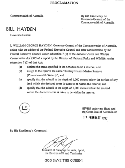


Attachment 2:
Australian IUCN Reserve Management Principles to apply to the Solitary Islands Marine Reserve
and to zones of the Reserve (Part 10.04(b) of the EPBC Regulations, and set out in full in Part 2 of Schedule 8 to the EPBC Regulations)
The Sanctuary Zone
The Sanctuary Zone (IUCN category IA — strict nature reserve) will be managed primarily for scientific research or environmental monitoring based on the following principles:
– habitats, ecosystems and native species are preserved in as undisturbed state as possible;
– genetic resources should be maintained in a dynamic and evolutionary state;
– structural landscape features or rock exposures should be safeguarded;
– examples of the natural environment should be secured for scientific studies, environmental monitoring and education, including baseline areas from which all avoidable access is excluded;
– disturbance should be minimised by careful planning and execution of research and other approved activities;
– public access should be limited to the extent it is consistent with these principles; and
– scientific research activities will be carefully planned to minimise disturbance to the benthic communities.
The Habitat Protection Zone
The Habitat Protection Zone (IUCN category IV — habitat/species management area) will be managed to ensure the maintenance of habitats or to meet the requirements of collections or specific species based on the following principles:
– habitat conditions necessary to protect significant species, groups or collections of species, biotic communities or physical features of the environment should be secured and maintained, if necessary through specific human manipulation;
– scientific research and environmental monitoring that contribute to reserve management should be facilitated as primary activities associated with sustainable resource management;
– the reserve or zone may be developed for public education and appreciation of the characteristics of habitats, species or collections, and of the work of wildlife management;
– management should seek to ensure that exploitation or occupation inconsistent with these principles does not occur;
– people with rights or interests in the reserve or zone should be entitled to benefits derived from activities in the reserve or zone that are consistent with these principles.
The General Use Zone
The General Use Zone (IUCN category VI — managed resource protected area) will be managed mainly for the sustainable use of natural ecosystems based on the following principles:
– biological diversity and other natural values of the zone should be protected and maintained in the long term;
– management practices should be applied to ensure ecologically sustainable use of the reserve or zone; and
– management of the reserve or zone should contribute to regional and national development to the extent that this is consistent with these principles.
Attachment 3:
Australia’s Goal, Core Objectives and Guiding Principles behind the National Strategy for Ecologically Sustainable Development (Commonwealth of Australia, 1992)
The Goal is:
– Development that improves the total quality of life, both now and in the future, in a way that maintains the ecological processes on which life depends.
The Core Objectives are:
– Enhance individual and community well-being and welfare by following a path of economic development that safeguards the welfare of future generations.
– Provide for equity within and between generations.
– Protect biological diversity and maintain essential ecological processes and life-support systems.
The Guiding Principles are:
– Decision making processes should effectively integrate both long and short-term economic, environmental, social and equity considerations.
– Where there are threats of serious or irreversible environmental damage, lack of full scientific certainty should not be used as a reason for postponing measures to prevent environmental degradation.
– The global dimension of environmental impacts of actions and policies should be recognised and considered.
– The need to develop a strong, growing and diversified economy which can enhance the capacity for environmental protection should be recognised.
– The need to maintain and enhance international competitiveness in an environmentally sound manner should be recognised.
– Cost effective and flexible policy instruments should be adopted, such as improved valuation, pricing and incentive mechanisms.
– Decisions and actions should provide for broad community involvement on issues that affect them.
These guiding principles and core objectives need to be considered as a package. No objective or principle should predominate over the others. A balanced approach is required that takes into account all these objectives and principles to pursue the goal of ESD.
Attachment 4:
Seabirds of the Solitary Islands Region
Common name Genus and species
Gould’s petrel Pterodroma leucoptera
blue petrel Halobaena caerulea
common noddy Anous stolidus*
white-winged tern Chlidonias leucoptera*
lesser frigate-bird Fregata ariel*
white-tailed tropic-bird Phaethon lepturus*
sooty shearwater Puffinus griseus*
bridled tern Sterna anaethetus*
common tern Sterna hirundo*
brown booby Sula leucogaster*
fleshy-footed shearwater Puffinus carneipes#
wedge-tailed shearwater Puffinus pacificus#
short-tailed shearwater Puffinus tenuirostris#
crested tern Sterna bergii#
caspian tern Hydropogne tschegrava~
Australian pelican Pelecanus conspicillatus
Australasian gannet Morus serrator
sooty oystercatcher Haemotopus fuliginosus
pied oystercatcher Haemotopus longirostrispied
Common name Genus and species
cormorant Phalacrocorax varius
great cormorant Phalacrocorax carbo
little black cormorant Phalacrocorax sulcirostris
yellow-nosed albatross Diomedea chlororhynchos
black-browed albatross Diomedea melanophyrs
little penguin Eudyptula minor
silver gull Larus novaehollandiae
southern giant petrel Macronectes giganteus
white-faced storm petrel Pelagodroma marina
darter Anhinga melanogaster
little pied cormorant Phalacrocoraxmelanoleucos
westland petrel Procellaria westlandica
mottled petrel Pterodroma inexpectata
black winged petrel Pterodroma nigripennis
Buller’s shearwater Puffinis bulleri
gull-billed tern Sterna nilotica
white-fronted tern Terna striata
Key: *indicates listing under JAMBA and CAMBA; # indicates listing under JAMBA only
~ indicates listing under CAMBA only
Source: Zann 2000, Table 1.2 in Appendix 1.2
Attachment 5:
Raptors sighted in or near the Reserve
Common name Genus and species
white-bellied sea-eagle Haliaeetus leucogaster
brahminy kite Milvus indus
whistling kite Milvus sphenurus
osprey Pandion haliaetus
swamp harrier Circus approximans
brown goshawk Accipiter fasciatus
Source: adapted from Zann 2000, Table 1.4 in Appendix 1.2
Attachment 6:
Whales sighted in or near the Reserve
Common name Genus and species
blue whale Balaenoptera musculus
southern right whale Eubalaena australis
humpback whale Megaptera novaeangliae
minke whale Balaenoptera acutorostrata
pygmy killer whale Feresa attenuate
pilot whale Globicephala sp.
pygmy sperm whale Kogia breviceps
dwarf sperm whale Kogia simus
Gray’s beaked whale Mesoplodon grayi
strap-toothed beaked whale Mesoplodon layardi
killer whale Orcinus orca
melon headed whale Peponocephala electra
sperm whale Physeter macrocephalus
false killer whale Pseudorca crassidens
Source: Zann 2000, Table 1.5 in Appendix 1.2
Attachment 7:
Dolphins sighted in or near the Reserve
Common name Genus and species
bottle-nosed dolphin Tursiops truncatus
Fraser’s dolphin Lagenodelphis hosei
common dolphin Delphinus delphis
Risso’s dolphin Grampus griseus
spotted dolphin Stenella attenuate
striped dolphin Stenella coeruleoalbas
spinner dolphin Stenella longirostris
Source: Zann 2000, Table 1.6 in Appendix 1.2
Attachment 8:
Seals sighted in or near the Reserve
Common name Genus and species
Australian fur seal Artocephalus pusillis
New Zealand fur seal Artocephalus forsteri
leopard seal Hydrurga leptonyx
southern elephant seal Mirounga leonia
Source: Zann 2000, Table 1.7 in Appendix 1.2.